Cloudy skies are so much more interesting than blue skies. After interviewing Dave and Mary Nicholson about their six months’ stint on Maatsuyker Island and discussing in particular their weather watch routine, I got all excited about cloud observations and cloud photos.
Clouds are beautiful, but all have messages too! They are very useful to gauge the kind of weather which is developing and might affect your sailing activities, or other weather dependent pursuits. So I decided to rummage through my collection of cloud photos and read up on the various cloud types, heights and forms, as well as their meaning.
Cloud Types
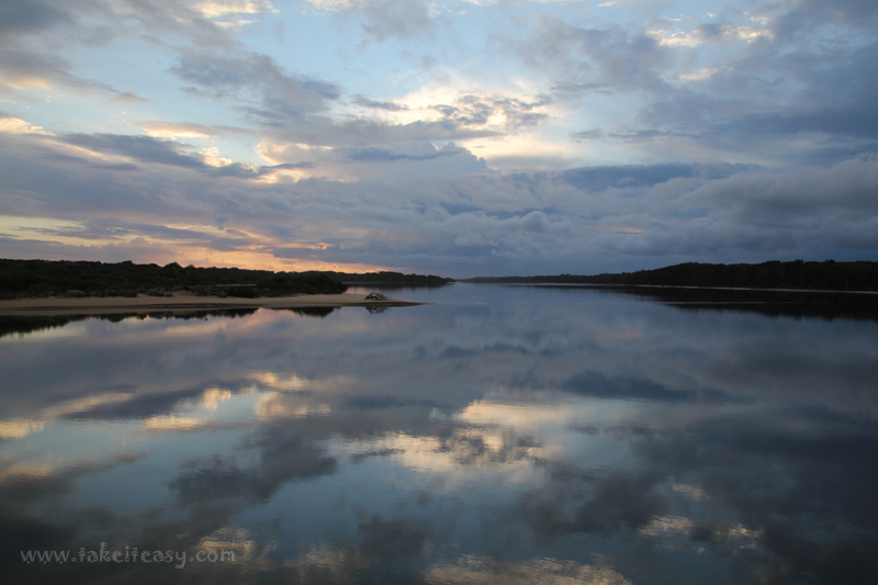
Strato-cumulus reflected in the Bunga Arm, Gippsland Lakes
At a lower altitude (less than 7,000ft) you will find the stratus, strato-cumulus and nimbo-stratus. The stratus are uniformly flat, horizontal layered clouds, most often associated with fog. The strato-cumulus are a lumpy layer of clouds varying from light to dark grey, which typically produce drizzle or intermittent rain. The nimbo-stratus is a uniform, dark grey layer of clouds that produce light to moderate precipitation. From a photographer’s point of view, these lower clouds produce rather moody scenery as seen in the photo at the Bunga Arm.

Cloud base at the Strzelecki Peaks, Flinders Island
The middle level (7,000ft to 20,000ft) is the domain of the cumulus, alto-cumulus and alto-stratus. The cumulus are the well known puffy cotton balls or cauliflower shaped clouds, which indicate fair weather. The alto-cumulus show small bands of rolled patches of clouds, with a distinct shaded area. They indicate thunder showers on a warm humid day. The alto-stratus are uniformly light grey sheets of clouds, which indicate continuous rain or snow.
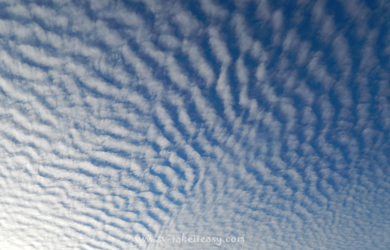
Cirrocumulus over Maatsuyker, taken by David & Mary Nicholson
The high level clouds consist of the cirrus, cirro-cumulus and cirro-stratus. In the main they are ice clouds. Cirrus are wispy, delicate looking clouds which are a sign of an approaching warm front. Cirro-cumulus often are a layer of tiny individual clouds, which look like scales on a fish, hence the term mackerel sky. These indicate unsettled weather. The cirro-stratus are an opaque almost see through sheet or layer of clouds usually indicating rain. Despite the poor weather warning, the high level clouds and their stunning patterns are my personal favourites.
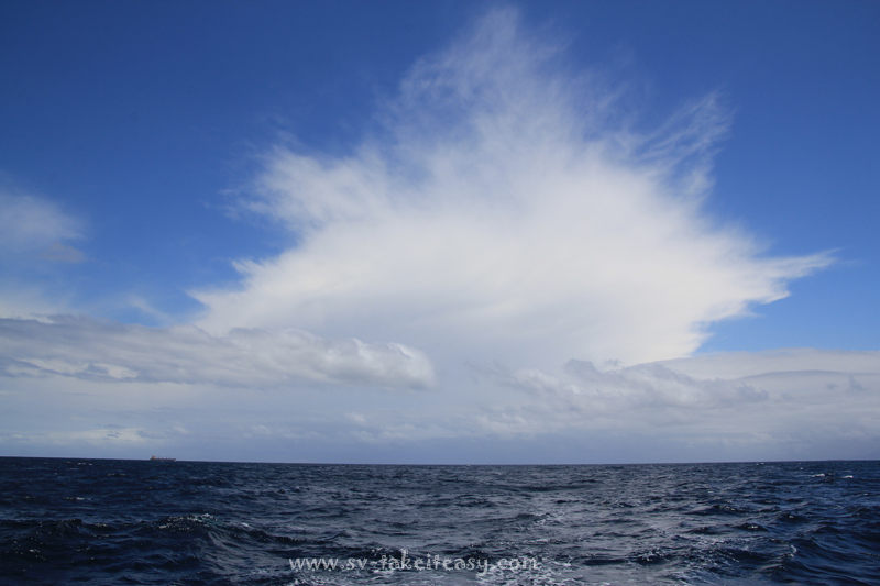
Cumulonimbus past Wollongong with dense cirrus
And then of course there is the monster – the cumulonimbus, which grows vertically and can extend from near the ground to over 20,000ft high thunder clouds. These are associated with severe weather, including hail, lightning, as well as rain and snow. Anybody who has sailed with Wade will know he does not like thunder nor lightning! But you have to admit: the shapes are rather impressive!
Some of the clouds are easier to recognise than others and there are many subsets not listed here. Often you get a combination up in the sky which challenges your ability to properly identify them. Even after months of weather watching, our friends on Maatsuyker Island still find some clouds difficult to pin point. So I suspect it will be an on-going learning project for a few of us! It is all part of the fun. We would love to hear your thoughts and see some of your own photos!
Cloud photos
Here is a selection of cloud photos taken in a range of locations and weather conditions. Can you guess what is what?


Hi Chris & Wade, lovely shots. When I joined the R.A.A.F,in 1943, at ITS, we did quite a bit of study….including MET….You are right, clouds are fascinating; so for me, it was interesting to hear again of the different types & to see them in real life colour……Craig would be proud of you…Frank
Hi Frank, thanks for the nice comment and glad you enjoyed the post.
Awesome cloud photos, Chris! I vaguely remember learning about clouds in meteorology class in high school, that was a looooong time ago. heh. Thanks for the refresh and the beautiful photos to go along with the lesson. 😀
Wonderful thank you! Your photos are amazing. 🙂
Thanks Viki!
Pingback: Meteorology – Clouds | Astrolabe Sailing
Loved reading this thank you
Glad you did, Krista and I hope you will be interested in reading more recent posts on our website.