This week we experienced some wild days while visiting a few anchorages in the Furneaux Group! We are after all in the Roaring Forties where strong westerly winds blow and really pack a punch!
This chart shows the main islands of the Furneaux Group, and we have marked the places we visited this week with an orange dot.

Not many people realise there are about 80 islands in the Furneaux Group, only being aware of the largest: Flinders Island. However not all islets are suitable to hide behind; in fact only a quarter of the Furneaux offer reasonable anchorages which generally give protection from only one direction. You therefore must be prepared to move at short notice to the whim of the wind. The main challenge when cruising the Bass Strait Islands is the fast-changing weather systems that switch from roaring westerlies and southwesterlies to Northeasterlies in summer for a day or two then back to the west. So it is best to have no fixed plan of where you want to go, just a few options in mind, and see what the weather lets you do. As we often say, cruising Bass Strait is about sailing from one hidey hole to another! It also pays to have time and be patient, as you can get stuck in one place for several days.
In this post we are taking you to a few favourites: Roydon Island, off the NW coast of Flinders Island, Trousers Point on the SW end of Flinders and Badger Island, west of the Franklin Sound. It is a longer post with lots of photos, so sit back, relax and enjoy the virtual cruise!
Roydon Island

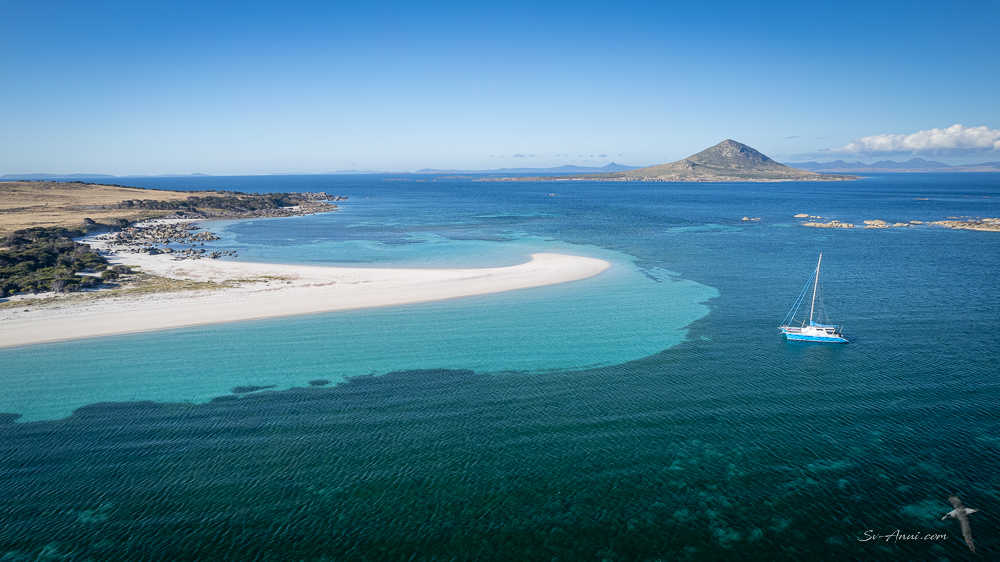
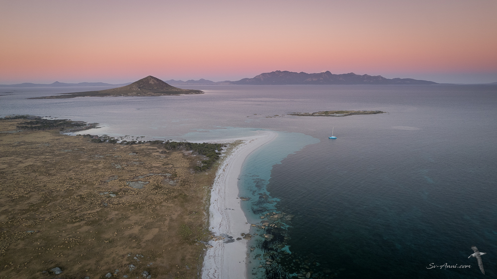
Roydon Island is quite small, only 37 hectares, lying in eastern Bass Strait off the north-west coast of Flinders Island. In gentle conditions, the anchorage has a lagoon feel, sheltered behind a pyramid-like granite hill with a lovely beach at its base.
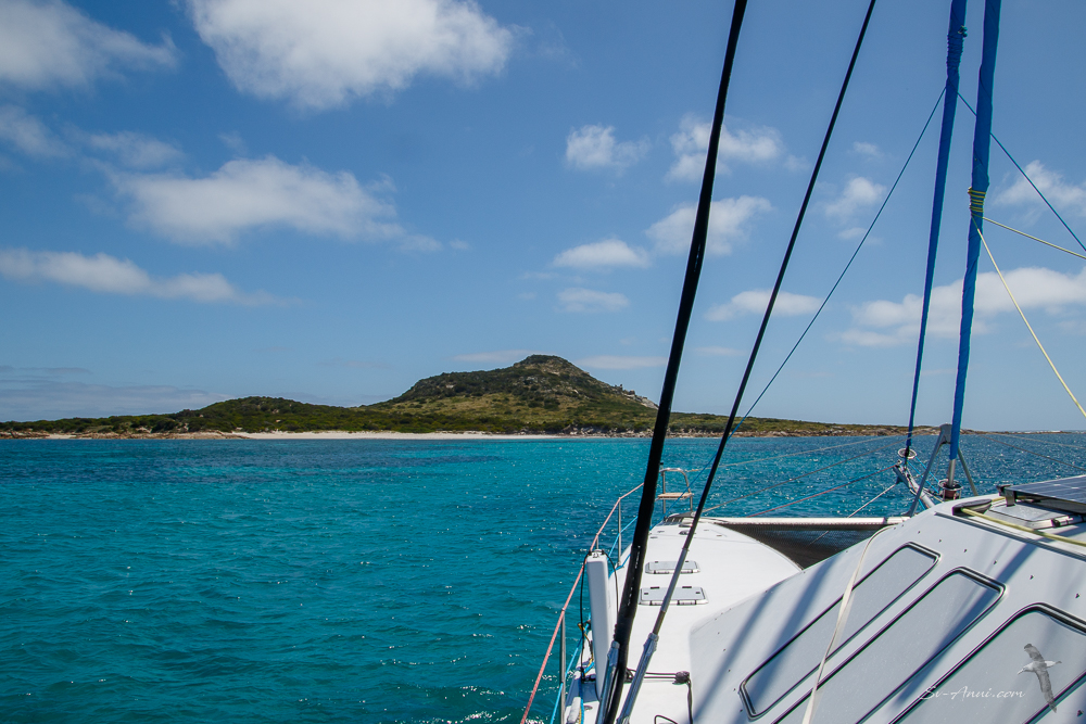
The advantage of this islet is that it offers good shelter in a westerly or SW, but you can shuffle across to the Flinders Island side just 500m away if the wind shifts to the NE. Not quite an all-weather anchorage, but as good as it gets here! We did have to do the shuffle a couple of times, one of them in the middle of the night, so fickle was the weather!
Here is what it looks like from the air:

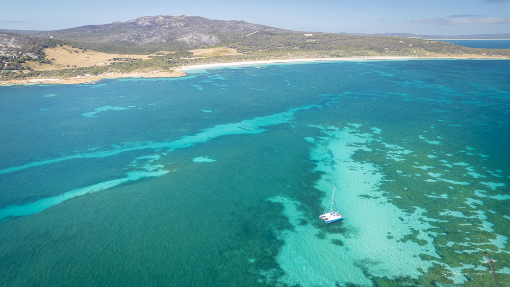
As you can see from the shots, there are a few patches of sand among large expanses of the green ribbonweed. You have to ensure the anchor is in sand, so it holds. If you end up in the ribbonweed, the anchor slides and the boat drags! The anchorage is also quite shallow with a few rocky reefs around.

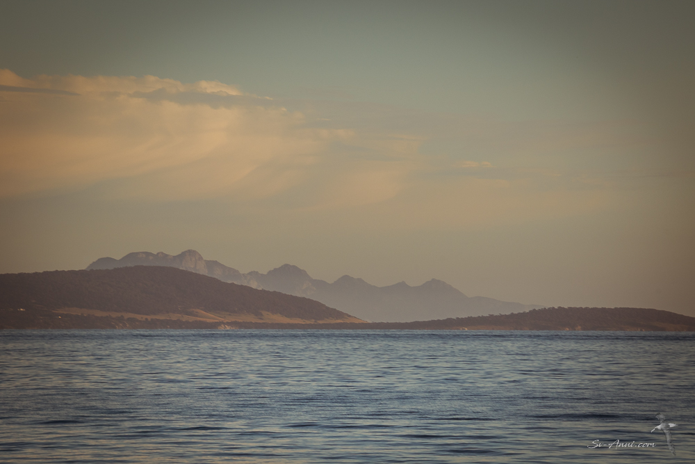
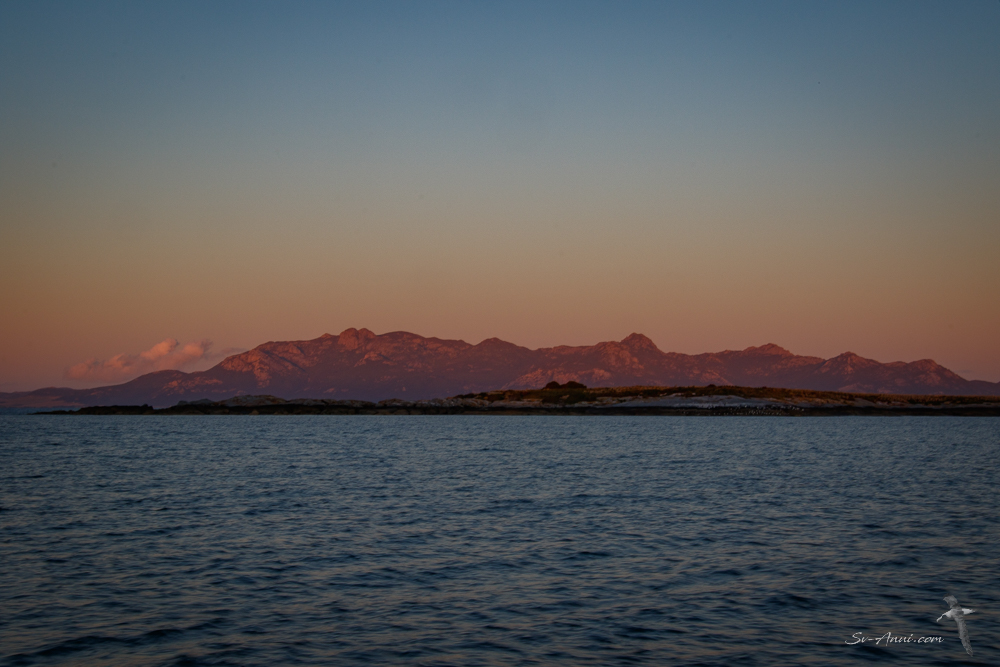
One of the delights of Roydon Island is the beautiful sunsets and the views north and south. To the north is Cape Frankland; to the south, are the imposing Strzelecki Peaks. On a calm clear night you see the Milky Way and you can go to the beach to watch the Little Penguins come ashore as they return to their burrows. We had one clear night; the rest of the time, it was blowing a gale with menacing clouds, so no star nor penguin gazing. Here are a few shots of our surroundings in different moods.


While the Sydney to Hobart race yachts were getting hammered on their passage south, we were too, registering 56 knots behind Roydon during our second night there. The wind was roaring, the boat rearing at anchor in the gusts and moving around in the short chop. And we had some rain and thunderstorms.

During the strongest night, we had all the navigation gear turned on, Wade sleeping in the saloon to keep an eye on the instruments and be ready for action. But we were safe.
Here are a couple of images taken when the wind was blowing at ‘only’ 35 knots. The bay looks positively calm, but of course pictures at sea are always deceivingly flat! And after you have seen the sea state at 56 knots, 35 is a doddle, really!


Once the westerly wind eased somewhat, we were able to get ashore a couple of times. Here are a few images from our walks. One day we visited the hut and took Bengie for a little beach wander. The other we rock-hopped right around the island. The orange lichen over the granite boulders, the birdlife, the sea state all contributed to making this an interesting hike.

Off for a beach walk at Roydon 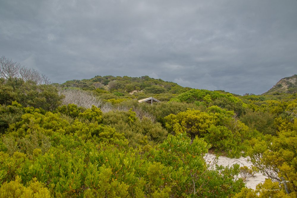
The hut at Roydon Island 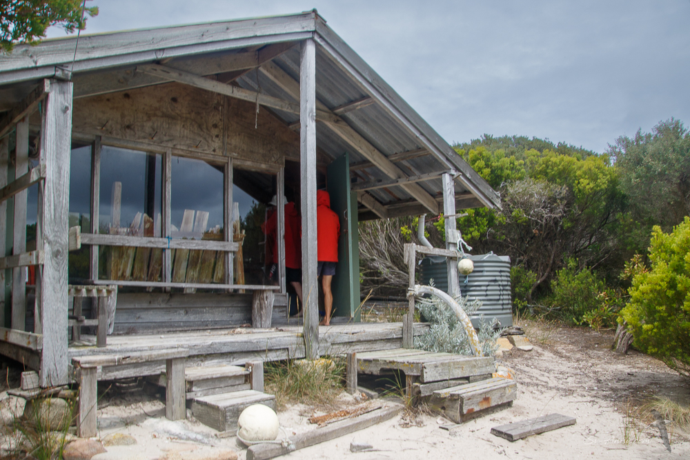
The hut at Roydon Island 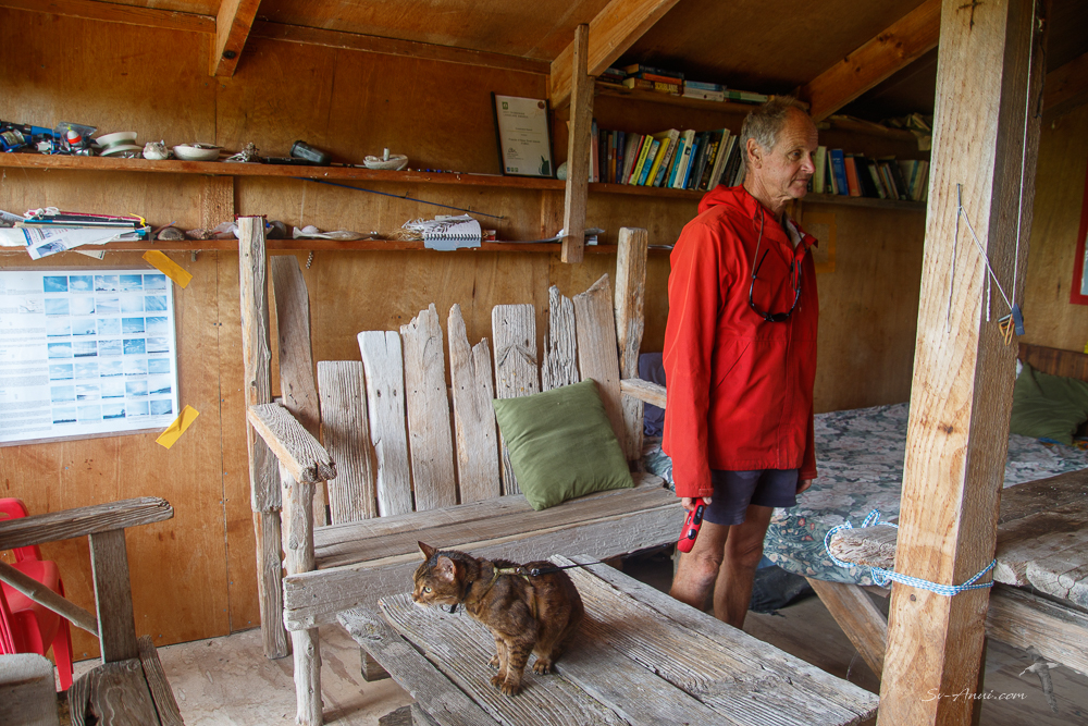
Inside the hut 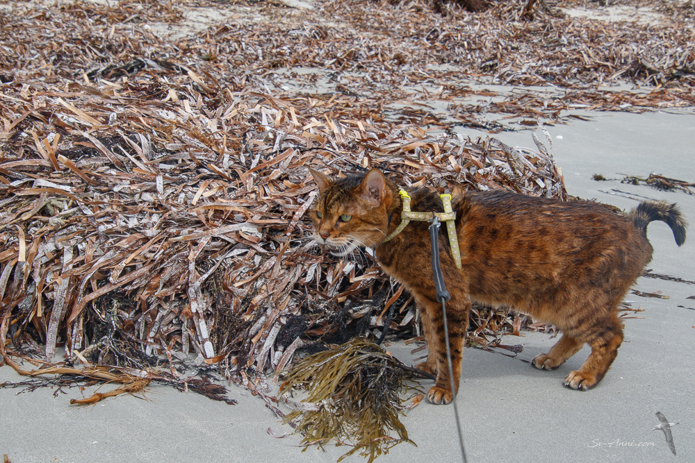
Bengie among the ribbonweed 

Lichen covered granite 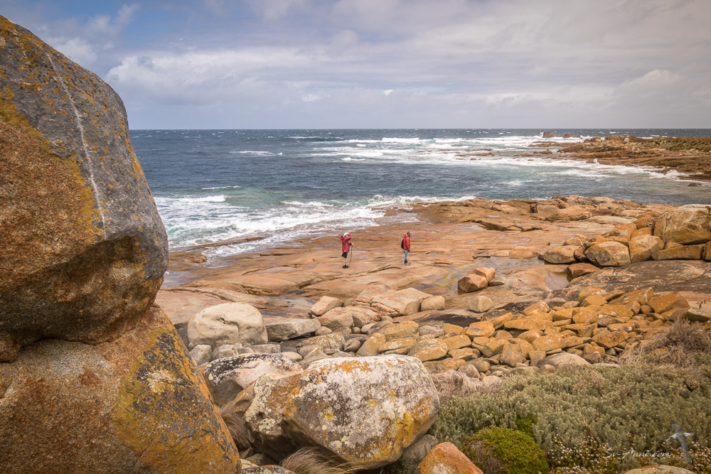
Walk along the rocky shores 
Trevor about to get wet! 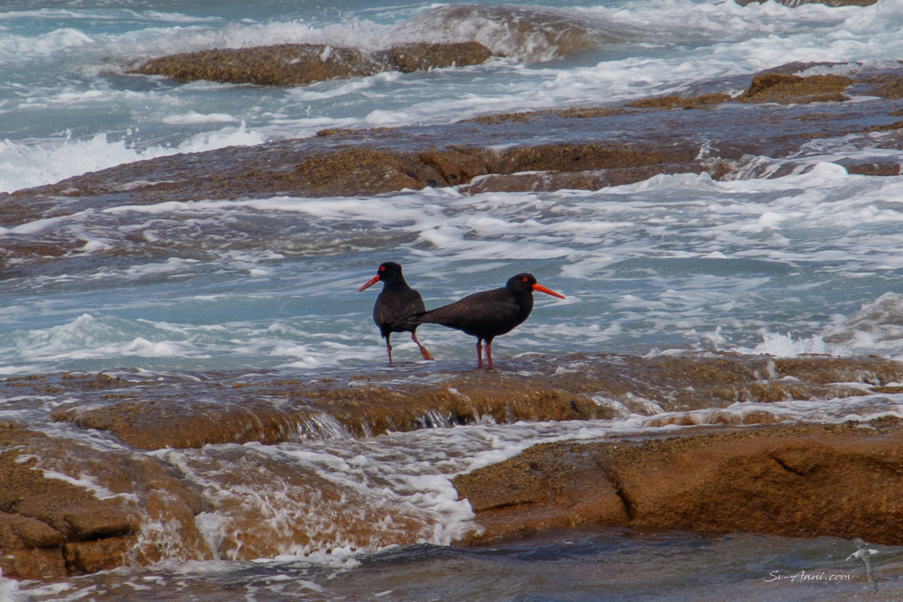
Sooty Oystercatchers 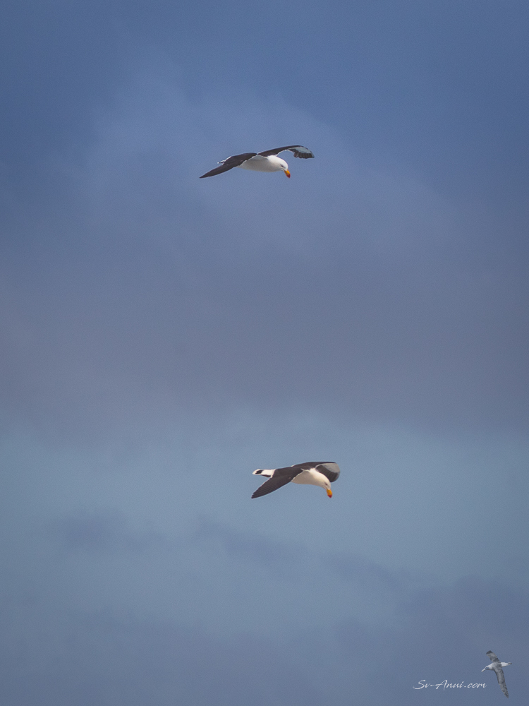
Pacific Gulls 
Cape Barren Goslings 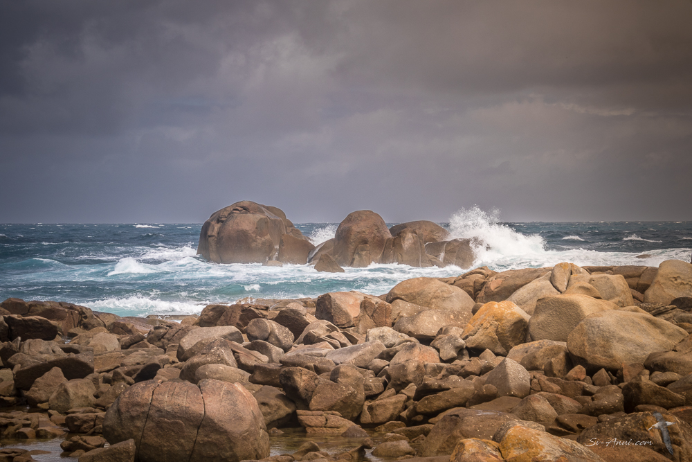
Wild shores 
The Summit at Roydon Island 
Caspian Tern 
Sooty Oystercatcher
Trousers Point – Flinders Island
With some kinder weather at last, we sailed 33nm from Roydon to Trousers Point, a lovely bay at the SW end of Flinders Island, briefly stopping at Whitemark on the way for fresh food reprovisioning.
Trousers Point is a gorgeous anchorage with a beautiful beach and coastal walks around the rocky headland to Fotheringate Bay on the northern side. The renowned Strzelecki Peaks dominate the bay, demanding to be climbed! One story behind the name of the bay is that a box of trousers was discovered on the shore, washed up from the wreck of the Cambridgeshire in 1875.


The Strzelecki Peaks Walk
For our second time up this mean mountain it all worked out well. On New Year’s Eve, the forecast was for sunny conditions with light winds. We reached Trousers Point the previous afternoon and picked up the one and only public mooring. This meant we could safely leave the boat unattended and not have to worry about dragging in the slippery sea grass.
The Strzelecki Peaks is a hike with breathtaking scenery, but it is a tough one: a 6.3 km return from the base at sea level to the top of the 756m granite mountain. However we also have to add a 6kms return walk on the road from the beach to the official start of the trail. This is classified as a Hard, Grade 4 hike. The climb is relentlessly steep, and any excuse is used to make numerous stops as your legs and lungs are burning and your heart is pounding… photos of the scenery, gazing at the wildflowers, having a drink of water, more photos, wondering why on earth you are putting yourself through this… We found it hard 12 years ago and even more so this time, but we did it! Slow and steady wins the race! It was a fitting end to a tough 2024 year. Unfortunately the summit did not clear until we were well gone, but we managed to get brief views at the top as the clouds were wafting in and out. Luckily once back on the road we managed to score a lift back to Trousers Point from a kind local. Now we are rather crippled, but look at these photos!

The Strzelecki Peaks shrouded in cloud 
Mt Strzelecki from the track entrance 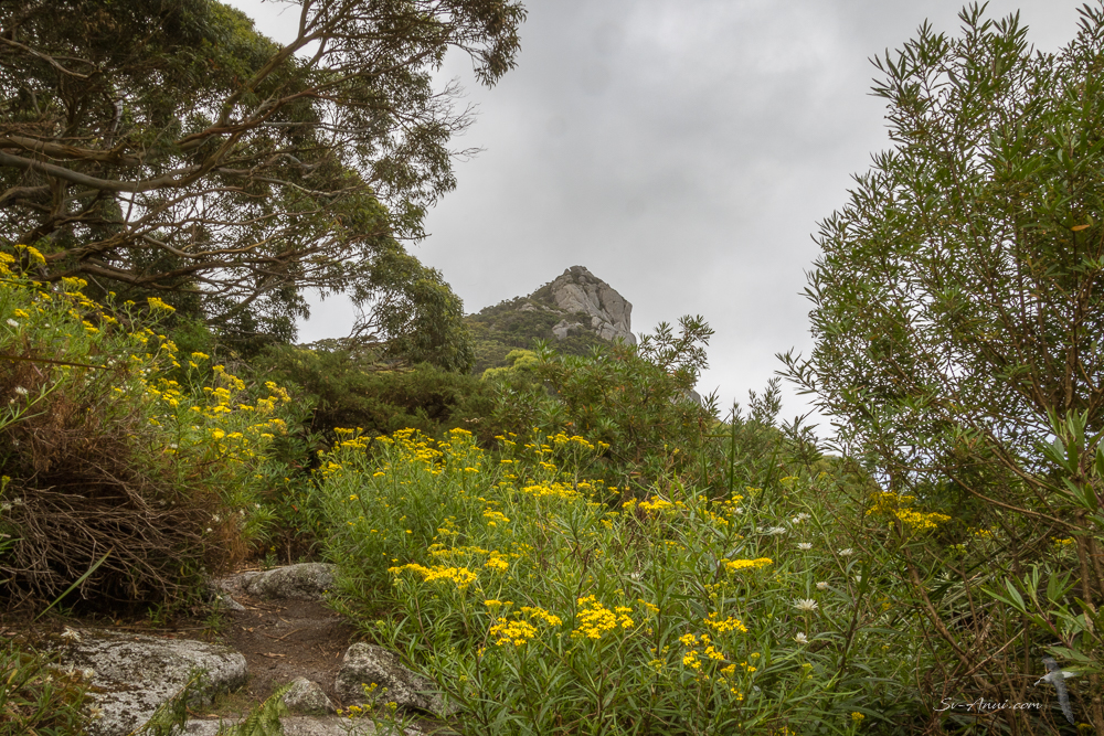
Wildflowers as we climb 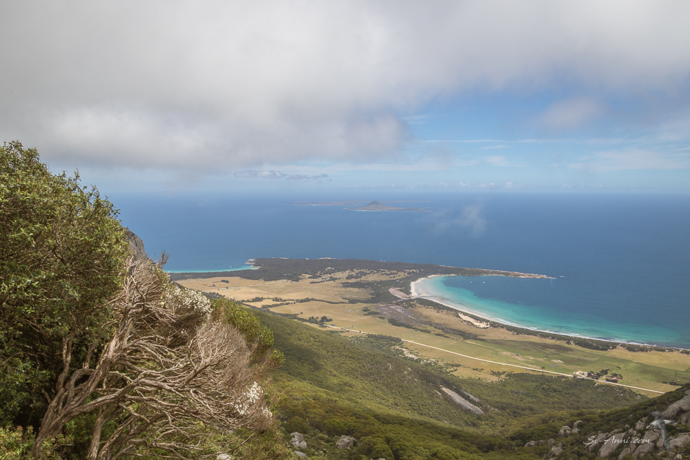
Trousers Point , Mt Chappel and Badger Island 
Chris close to the saddle at Mt Strzelecki 
Looking towards Lady Barron 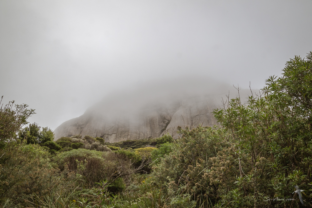
We’ve hit cloud base! 
Chris at the saddle, Mt Strzelecki behind her 
Trevor at the top of Mt Strzelecki waving 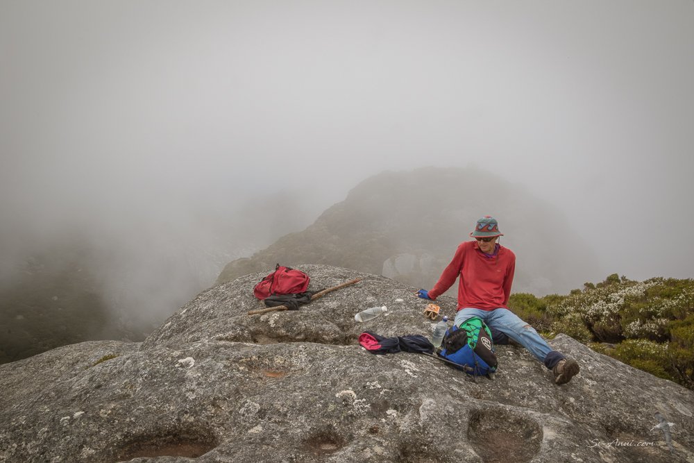
Picnic at the summit 
The views towards Trousers Point and Mt Chappel in the distance 
Badger Island
With strengthening westerlies forecast, we escaped straight after the hike across to Badger Island, a low-lying granite and limestone island about 8nm away. The isle is said to have got its name from early settlers who saw the furry creatures we call wombats, and thought they looked like badgers! The island vegetation has changed drastically: deforestation to make way for grazing sheep.
We had some trouble finding a suitable anchorage because of the ribbonweed, but eventually dropped the pick in sand near the spit at Lucy Bay.
What a beautiful evening we had for New Year’s Eve, visited by dolphins, gazing at the Strzelecki Ranges all clear at sunset, enjoying a tasty dinner prepared by Trevor and a very special bottle of sparkling shiraz!
We are now hiding from the strong wind and resting our old bodies – some much needed recovery time. We moved to the northern side of Badger Island as the wind shifted to the southwest.

Happy New Year to you all. See you somewhere in the Furneaux Group next Friday.


Wow, what an exciting week you guys have had! Happy New Year! Thanks for the beautiful photos. ❤️😊
Hi John, yes we have kicked things up a notch this week. Enjoying ourselves.
Keep up the great enjoying! 😂🤘🏻
Hmm – well, to be honest, for me there has always been the south coast of Victoria and then the Bass Strait and then the north coast of Tassie and . . . oh, yes – that ‘small’ island called Flinders in-between! What an eye-opener this post is for New Year – may it be a very prosperous one for you!!! Love the photos, especially the collection in the middle . . . it ‘looks’ cold and the skies are different . . . and the blue of the sea looks grey . . . interesting . . . am looking forwards to next week . . . be well!
Hello Eha, we wish you a much kinder year to you as we do for ourselves!
Glad you enjoyed the discoveries. There is so much to sea here.
Yes the colours are different here: teal seas, sometimes inky when the weather is mean. And yes the skies look different to the tropics! It is chillier too but we have a few days of high 20s which we will lap up.
Great post. Really feel like one is there with you. You know you are in the “roaring forties” Glad all is going well. Enjoy
Hi Graham, Everything is different here, the colours, the textures, the temperature, the wind… we love being back here!
Such a gorgeous part of the world you boated us about in a few years ago now when you picked us up at Trousers Bay. How lucky we were. Glad you’re exploring and enjoying again.
Hi Ann, we had forgotten about picking you up at Trousers Bay! That’s right you flew in to Whitemark and somehow got a lift to the bay!
Great photos. We have been thinking of you… apparently as well as windy, it has been a bit chilly down there. And it is nice to see anchoring at Badger is doable… we clearly didn’t try for long enough…. 🤣
Hi Trish, yes Badger works, you have to be precise with dropping the anchor in the sand patch and be prepared to move as the wind shifts. It was easier with Take It Easy with only 80cm draft and mini keels.
What an excellent voyage, 56kts and all! Your drone really enhances the scenery of all the islands you’ve visited, great pics once again 😉
Hi Elgar, the drone has really given us a different dimension and views we never had when we first visited these places between 2005 and 2010 on Medina and between 2011 and 2018 on Take It Easy. It is really special to be going back to a few favourites on Anui. Not a lot of changes above the surface, but a lot more seaweed and a lot less abalones under the waterline.
Pity about the lack of abalone, you’d enjoy the change in sea food from the tropical!
Everything deteriorates, even here!
Happy New Year! Thank you for your fabulous photos and informative post. You are right, most of us don’t know about all those islands in Bass Strait. Was wondering how you were faring as the Sydney to Hobart was being reported through the media. Well done on completing your hike…hard to do with minimal training. Recover well!
Hi Jan, thanks for the feedback! As we mentioned in the post while the Sydney to Hobart yachts were struggling in the high wind and rough seas, we were sitting at Roydon island in gusts of 56 knots westerlies, but safe at anchor. We have been revisiting anchorages we frequented some 15 to 20 years ago. They haven’t changed much but our bodies have despite trying to stay active!
Thank you for a great post that is very informative. I hope to be in the area in a few weeks and look forward to checking out some of your stops 🙂
Fair winds,
Colin on Magique
Thanks Colin, have fun!
Gorgeous photos as always. Such a beautiful and lesser explored part of Bass Strait. Well done on the climb! It’s on our list, but someone keeps balking at the 6 km walk to the start of the climb 🤣
We farewelled our last family guest yesterday and slipped out of Sydney Harbour today. We’re tucked up in Port Hacking for a few days recovery and to sit out the wet southerly and then southbound for us too!
If you get to climb Strzelecki, you should be able to get a lift from the campers at Trousers Point. We did on the way back!
Hope you get south quickly and we meet up somewhere on the Tassie coast.
Counting on catching up!!
Beautiful places to visit and enjoy! It’s wonderful you have so much knowledge about about the places you adventure to and know what to do and where to go when the weather becomes fickle.
Happy new year! Wishing you a blessed new year & happy and safe sailing.
Well these areas were our cruising grounds before we retired, so we do know them well. And we also like to do our research for info and safety!
All the best to you and your family too for 2025!
You talk about a world that I know very little of and it’s exciting to read about and see a part of your sailing adventures!
Very pleased you enjoy the adventures!
Now I know a lot more about the Flinders Islands group than I new before only the fact that they are in Bass Strait. Great images hope to sail down there in the future. Happy New Year & fair winds.
Cheers Mick & Lyn
Beautiful cruising grounds. Hope you get to explore them one day!
Comment received from Sue Marlin
My goodness the weather was disgusting for all the boats in the Bass S. You included. You are having a good time with lots of exercise which is what you need.
I have been spending a little time in the garden and trying to get things SLOWLY under control. I still get rather puffy.
Stay safe out there in your hidy holes.
Love Sue
Such a long recovery for you Susie! But good you are staying active.
We were safely anchored during the worst of the wind, so all ok.