This week you are in for a treat. We are taking you to three stunning spots which are the highlights of our Furneaux wanderings. It is a feast of shapes, colours and textures.
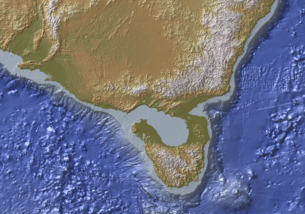
Here is the same map as last week, but this time we are focusing on the southern end of the Furneaux and have marked the spots in purple.
We spent our time on Cape Barren Island, the second largest island of the Furneaux Group in beautiful calm conditions, and hid from a blow on Clarke Island, the third largest!
Key Island Bay
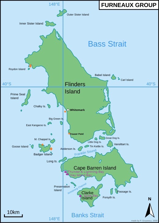
With a very different feel to anywhere else we have ever anchored in, this bay stole our heart many years ago. At first glance Key Island Bay is just another shallow cove with lots of seaweed as you approach the main sandy beach, making a firm anchor hold difficult, and with numerous granite boulders on either side threatening to create havoc. But if you are brave, there is a hidey spot behind Key Island itself with a sandy hole among the seaweed and its own private cove.

Unlike the main beach, this nook offers protection from multiple directions, and even better, there is only room for one boat. This means privacy and leaves the skating rink in the main bay to any other boat! The granite boulders are close and from a distance the boat looks like it is anchored among them, but it is safe, calm and oh so beautiful and unusual. We were there all by ourselves in magic calm and sunny conditions, the pick of the weather since the start of our voyage.

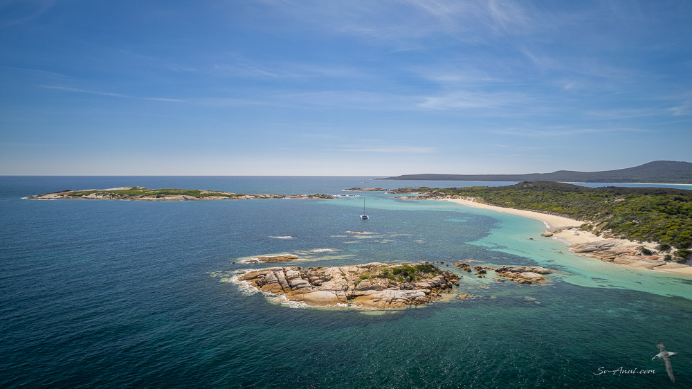
It might look tropical in the sunshine and uncommon heat – mid to high 20oC – but the water is rather cool at 15oC. We went for a snorkel and were toasty warm in our thick wetsuits, but Trevor did not last in his short arms/short legs! We were hoping to pick up a few abalones, however did not find any of legal size. Black lip abalones must be 12cms across and green lip abalones 14.5cm to be harvested. We used to be able to spot them from the boat in this bay, so clear was the water and so numerous they were but this is no longer the case. We did see several undersize ones as well as quite a few urchins, but let them be. It was after all 15 to 20 years ago when we were roaming the Bass Strait Islands and getting good feeds. Time flies and things change, sadly for the worst here too!
We enjoy what we can, though. It is always interesting to observe the very different colours underwater in temperate versus tropical waters. Here the dark green, russet and burgundy hues dominate.


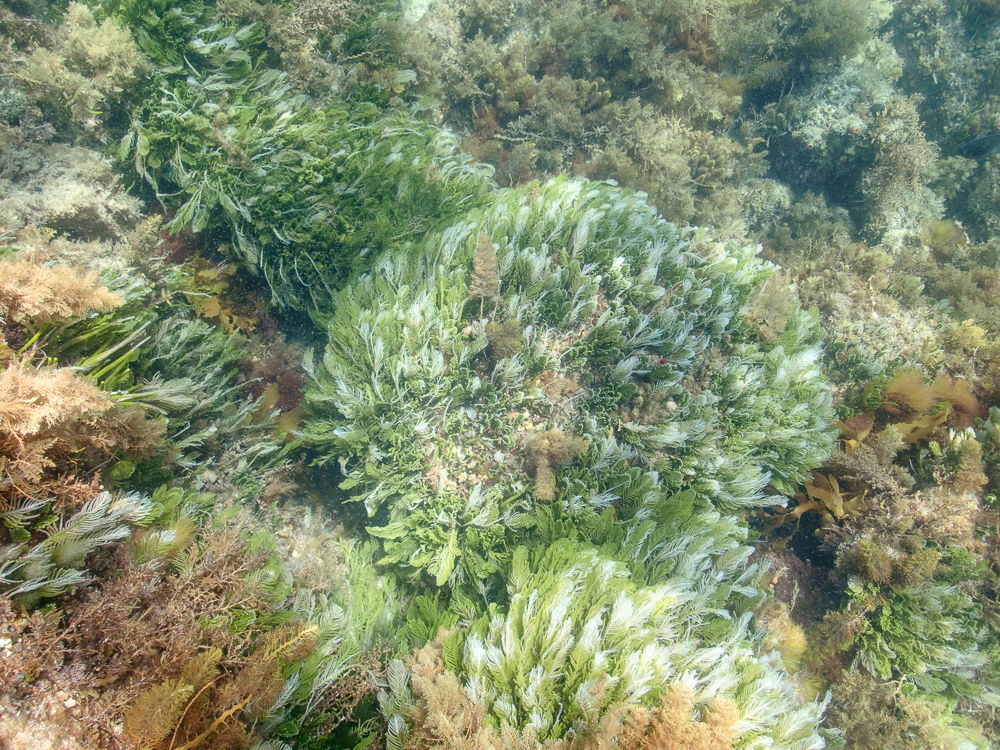
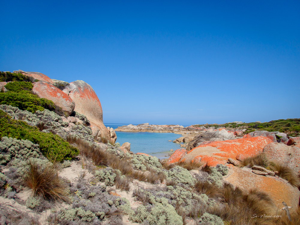
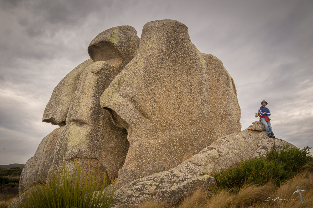
One thing that has not changed at Key Island Bay is our favourite rock we affectionately call The Bum!
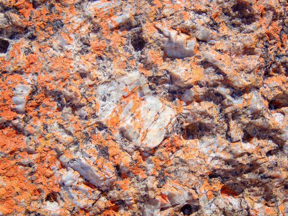
One of the pleasures of meandering around these parts are the colours and textures. The sand, the dry ribbonweed, the granite boulders, the orange lichen, the exquisite blues on a sunny day… everywhere you look something catches your eyes.

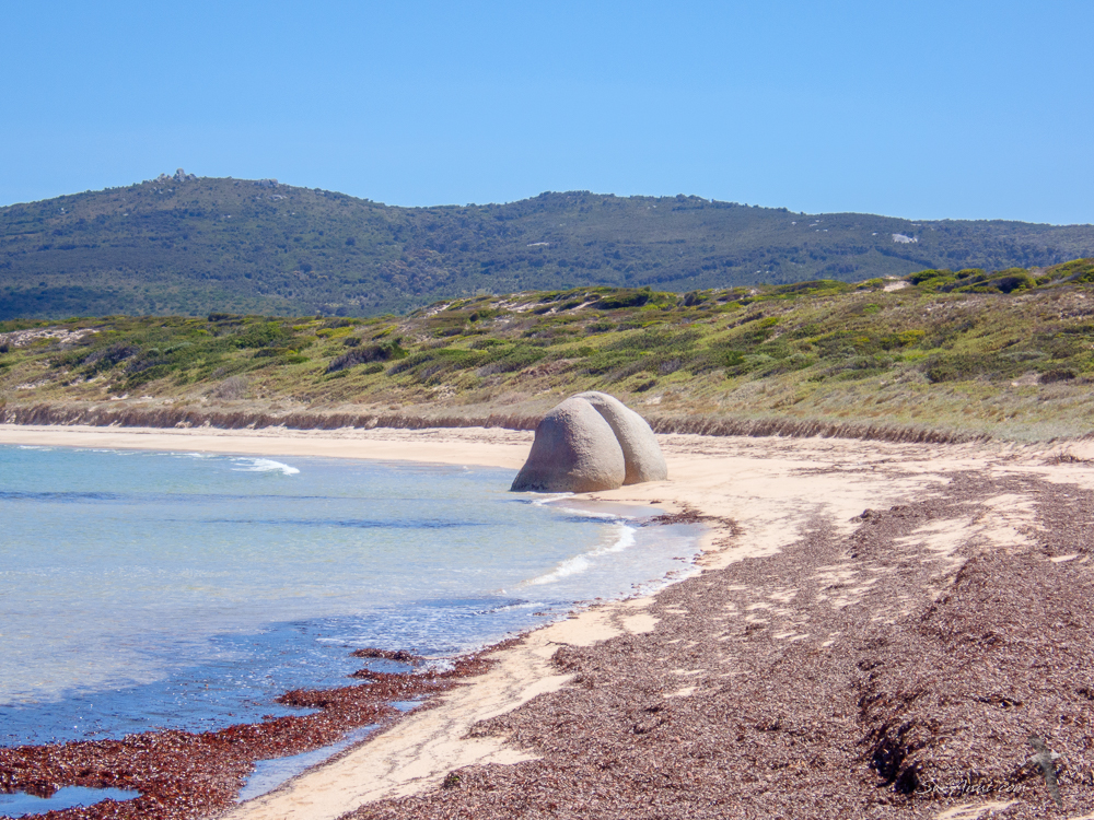


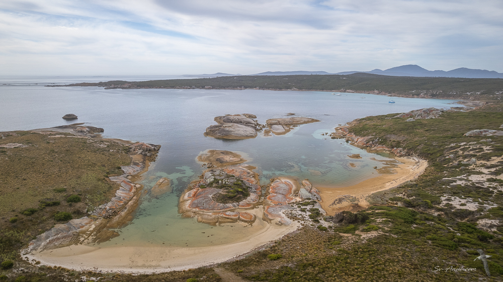
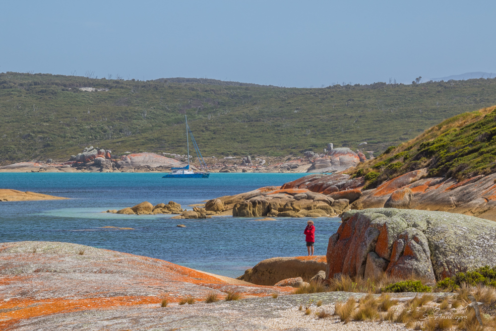
Thunder & Lightning Bay
Just next door to Key Island and to the north is Thunder & Lightning Bay, a large but shallow bay which provides protection from NNW through to SE. We did not anchor there this time, however walked to it during one of our hikes and Chris sent the drone over from the boat while we were in our hidey hole at Key Island Bay. This is what it looks like from the air:
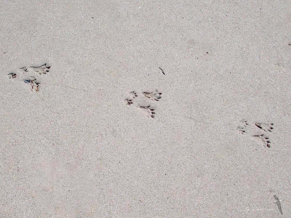
And here are a few shots taken during our hike across.


If you wonder where the daunting name ‘Thunder & Lightning’ comes from, it is not referring to the foul weather that can descend from the nearby hills. It in fact comes from a descendant of Mannalargenna, Chief of the aboriginal Ben Lomond Tribe. His fourth daughter was called Wobberertee, which translates as ‘Thunderstorm, Thunder and Lightning’. The bay is named after her. We bet it was not wise to argue with this woman!
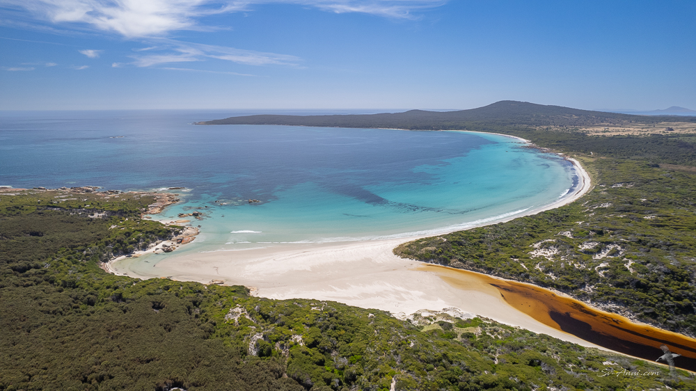
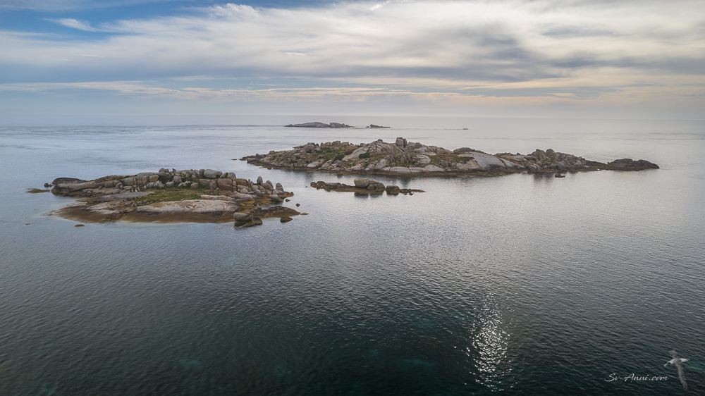
Spike Bay, Clarke Island
While the weather was favourable, we moved to Clarke Island, an 82km2 island, the third largest of the Furneaux Group, and anchored at Spike Bay on the west coast. There were three boats anchored when we arrived, but by the next morning they were gone. Spike Bay is large with a sandy bottom; it is often frequented by fishing boats and provides protection from anything except the west.
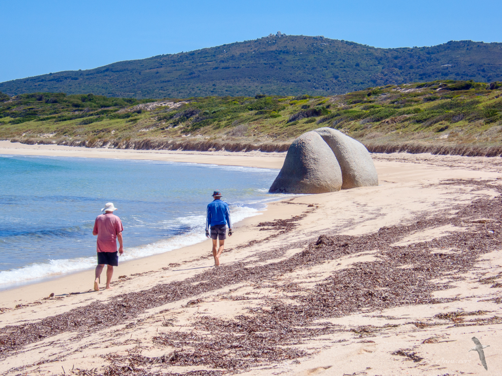
Spike Bay is another stunning cove which got its name from the spikes or granite outcrops that dominate the bay. Some of the tors are reminiscent of Easter Island statues!

This island has significant indigenous history. It is said the aboriginal peoples occupied and used the land until 6500 years ago, before the Last Glacial Period while it was still connected to the mainland, calling this place Lungtalanana. Before they became islands, the Furneaux, the Kent Group and Hogan Island were all part of the Bassian Land Bridge which connected Tasmania to Wilson’s Promontory on mainland Australia until it was submerged by rising seas around 12,000 years ago.
There are many archaeological sites on Clarke Island, showing evidence of aboriginal presence over a long period. These days the main settlement is located on the northwest corner. The island is owned and overseen by the Aboriginal Land Council of Tasmania. You do need permission to gain access beyond the beach, which we obtained.
We spent four days at Spike Bay, weathering a blow there and waiting for the right conditions to cross Banks Strait towards the Tasmanian northeastern shores. Here are a few aerials of this enthralling place.


This slideshow highlights the striking scenery around Spike Bay. Interestingly this is the only bay with so many rocky slabs and imposing tors on Clarke Island.


We have concluded our Furneaux wanderings on a high and have now crossed Banks Strait to begin the next phase of our voyage along the northern shores of Tasmania, travelling west. But that’s a story for another post. See you along the north coast of Tassie next Friday!


Wow, you aren’t kidding! Such a beautiful place, I like that big bum boulder! 😂
Glad you like these striking places, John… and the Bum!
I sure do, LOL!
Well, my delights this morning (before breakfast, so you appreciate what fun I find your posts on Friday mornings!) are ‘the Bum’ and Bengie very self-assuredly walking along the beach! Wonderful photo series with my favourite perchance being the Anui so beautifully hidden away amongst the rocks on Key Island . . . perchance not so colourful as some other areas but looking wondrously ‘cosy’ . . . thank you for all –
We are delighted too Eha that you appreciate these wild places and the few fun shots we included!
HNY to you both! I’m enjoying your Bass Strait island-hopping adventures. As you know, we’ve never sailed there. Sailing west, not the usual passage for a Tassie adventure, but I’m sure a well researched & also exciting one. And, that certainly is a great ‘bum’!
HNY to you both.
The Islands are well worth the trip. Anti-clockwise is the way at this time of year for a circumnavigation. We have done it both ways, but clockwise you tend to get stuck waiting for ever at Research then not being able to go north after Port Davey/Bathust Harbour.
Sounds like a good plan!
Wow, a treat indeed. A special place with lots of history. Thanks for taking us on the journey.
Our pleasure Graham, the island are a special places. You could easily make them your destination as there is a lot to see.
Yes indeed, They are on my (Long) list
Wow, great photo’s as usual, and I think I have now seen more hidden parts of my own state than I’ll ever see! Will keep the binoculars focused on the horizon for Anui if you get to the NW waters of our state.
Hi, intending to do a circumnavigation so should be at the NW end soon!
Thank you so much Christine for sharing this special corner of Australia with us. Stunning coves and fascinating history. Thanks for including the map of the Bassian land bridge – really puts Our early history into perspective.
Thanks for the feedback and pleased you enjoyed this post. There is so much to learn in this part of Australia.
Hi Guys, I am a long time follower but this is my first comment, my apologies, I’m sure it’s much more rewarding for you to get feedback from your readers instead of …….
It is interesting to see you back down our way again and to pick up on the changes here since your last trips.
Love the island hoping and as always the great pics.
Enjoy the west coast.
So, I for myself thank you, hope all your other readers appreciate it all.
Doug
Thank you Doug, for daring to write a comment. You are right, it is much nicer to get responses to our posts than silence, yet so few of our followers make the effort! Glad you did… Hope you keep writing a few words or reactions in the future. Enjoy the vicarious cruise!
Such gorgeous islands and so often overlooked. Thanks for all the beautiful photos!
Has Starlink been trouble free on your journey south? We’re 10 nm off the NSW coast and it’s been a bit patchy…
But at least we’re heading south in the right direction!
Starlink has been good, not always needed. Looking forward to seeing you on the Tassie coast. Will you be going down the East or West coast?
We are travelling west along the north coast now and it is a little ’plain’ after the wild Furneaux!
We’re planning to head down the east coast to catch up with friends who do a stint as volunteer rangers on Schouten Island in mid-February. But all plans are subject to change with the weather!
Might see you on the way back after Port Davey.
What a stunning place to visit. Some of these images seem to be familiar with images in Medina’s adventures which you would have been on 15-20 years ago.
Cheers
Mick & Lyn
Hi Mick & Lyn, that’s right, we started roaming the Bass Strait Islands that long ago on Medina, right up till we retired 8 years ago and were on Take It Easy. No change above the surface, but a lot less marine life under the surface.
Beautiful islands, scenery everywhere! On thing though, what is it with the Ben Lomond aboriginal tribe???!!! Mysterious Scottish connection?
Smooth winds and happy sailing guys!
My research tells me that Ben Lomond is a mountain in NE Tassie with imposing escarpments. It was spotted by Flinders during his circumnavigation, but the actual name was given by Colonel Paterson who founded the first settlement of ex Anglo people in NE Tasmania in 1804. The escarpments must have reminded him of the Scottish mountain. The Ben Lomond Nation, an aboriginal population consisting of three clans with 150 to 200 people, originally inhabited the area. These clans hunted in the nearby Esk Rivers and traces of their existence can still be seen today near the two peaks within the park. So that’s the connection, as with many places on the Tassie coast given French or English or Scottish names by settlers and explorers.
Thanks Chris, that’s a lot of local history! Small irony, we can almost see Ben Lomond from our place 😄
Where are you?
Firstly, this is Elgar, and I don’t know why WordPress gave me this new name on my mobile. Otherwise, south side of Glasgow, we have nearby views to the mountains and hills to the north.
Ah, weird. It makes sense now!
That’s an interesting bit of history and typical of the colonialist Brits naming the tribe thus.
Small irony …. we can almost see Ben Lomond from our place! It’s a nice day trek to the top of the mountain and back.
Irony and tragedy considering the way they treated the aboriginals: abductions, raids, forced relocation to Flinders Island, disease, mistreatment, just about killing them all. It is a very sad part of history.