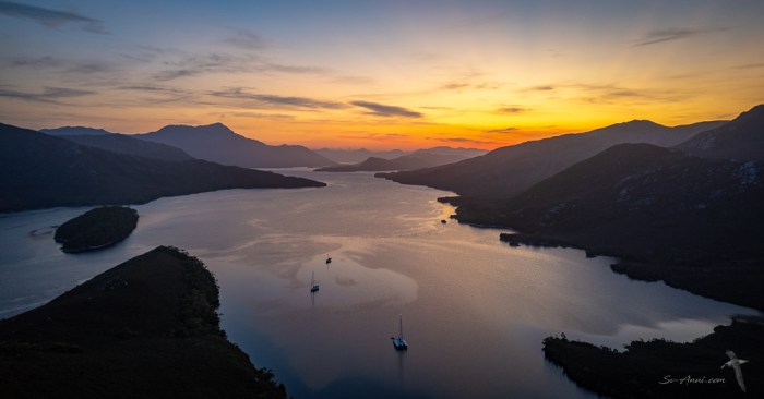
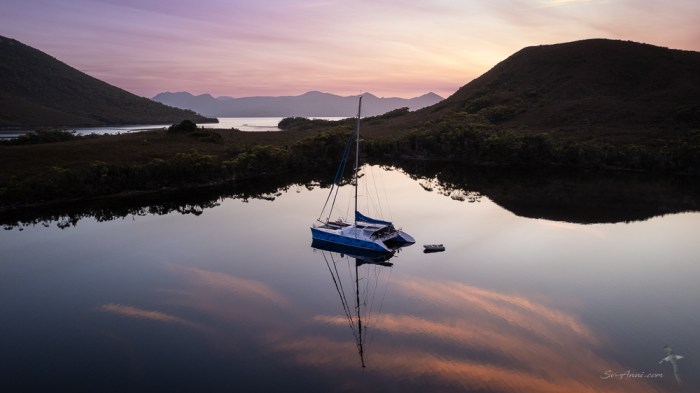
We are continuing our voyage along the wild side of Tasmania. This week we take you to exceptional Port Davey, in the heart of the Southwest Wilderness World Heritage Area in blissfully calm weather.
This is a superb part of our circumnavigation. Although we have been here several times, this is still a most captivating region for us. We consider it the ultimate in cruising Tasmania, and to do it justice we are again sharing a large number of images.
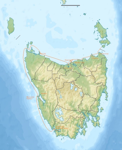
The sail from Macquarie Harbour to Port Davey
It was a dawn start with pink skies and albatrosses flying for our passage down the west coast to the next natural harbour. We sailed in company with Chris and Suzanne on Discovery II, their 46ft Outbound monohull. We have been exploring together on this leg of our circumnavigation.
The 85nm passage took us 12 hours of active sailing. We say active because we had confused seas with 3-meter swell coming at us from different directions… a bit like a Bass Strait crossing, only larger swell! The wind was steady at 15 to 20 knots, however it shifted from the west to the northwest thus more and more on our tail as the day developed. We had multiple sail changes to work the conditions, but in the end we goose-winged the main on one side, the jib on the other. We kept going at a respectable speed, averaging 7knots and kept the best for last, roaring in at 12 knots into spectacular Port Davey.
Two aspects stood out during this passage: the incredible bird life and the stunning scenery with high mountain ranges as the backdrop.
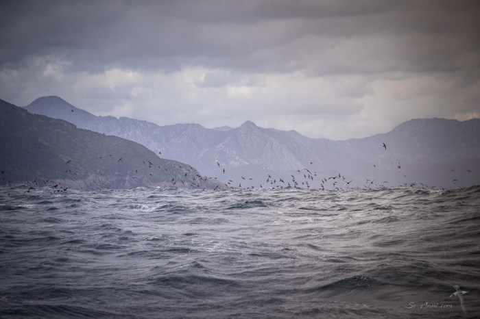
The albatrosses were hard to photograph with the heaving boat, but so magnificent to watch as they soared, banked one way then the other, disappearing behind swell lines, then reappearing as they rose high in the sky, their flight pattern repeated over and over.

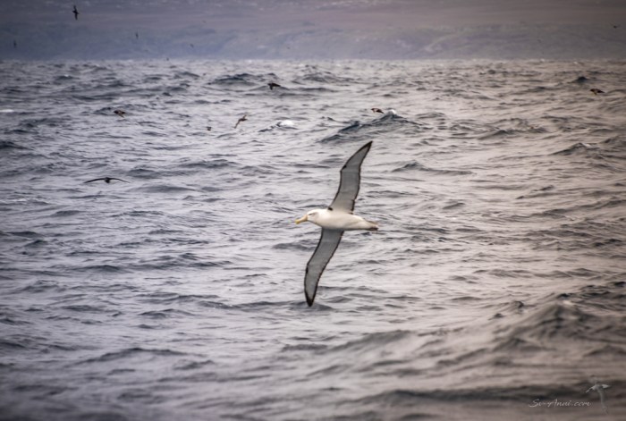
The closer we got to Port Davey the higher, more rugged, more spectacular the jagged mountains were. This really is a wild coast… and no other boat about other than our following cruising friends.

A bit about the Port Davey/Bathurst Harbour Marine Reserve
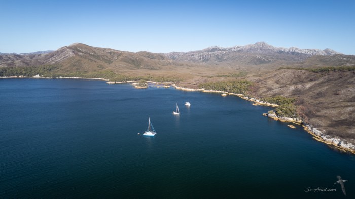
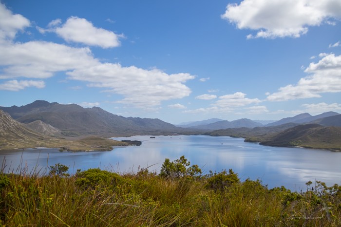
When we use the terms Harbour or Port around these parts, we are not talking about an urban area, nor a man-made boat shelter. These are natural waterways, valleys which were drowned when the sea levels rose after the last ice age. They are isolated, unpopulated, far away from any civilization. The Port Davey/Bathurst Harbour Estuary is as wild as you get: no roads, no habitation for several hundreds of kilometres, and the only way to get there is by boat, by foot or by air. The geology of the area is largely billion-year-old quartzites which give many of the rugged peaks of the region their distinctive marble-like look.

You can see from the satellite chart above that both natural harbours are connected to one another by a narrow channel. This is a very large area with many different anchorages and scenery, so you guessed it, this is another post packed with information and photos. No matter how many times you have been to this wilderness, you are in awe of the scenery.
Port Davey is quite exposed, being open to the Southern Ocean. Swell comes a long way into the harbour. But we have been incredibly lucky with this weather window and it looks like we have over another week of calm conditions.
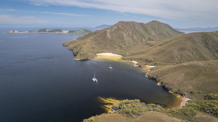
Our first anchorage within Port Davey was at Bond Bay.

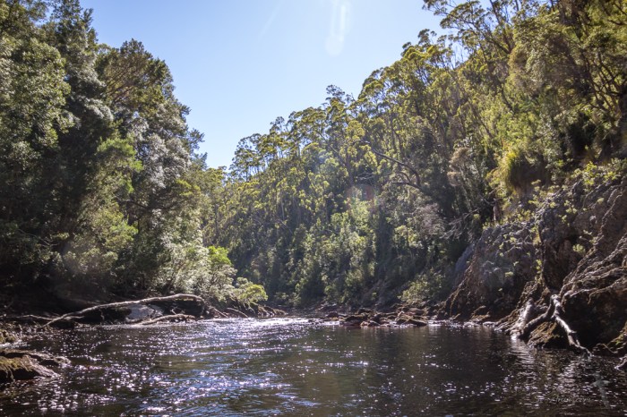
Up the Davey River
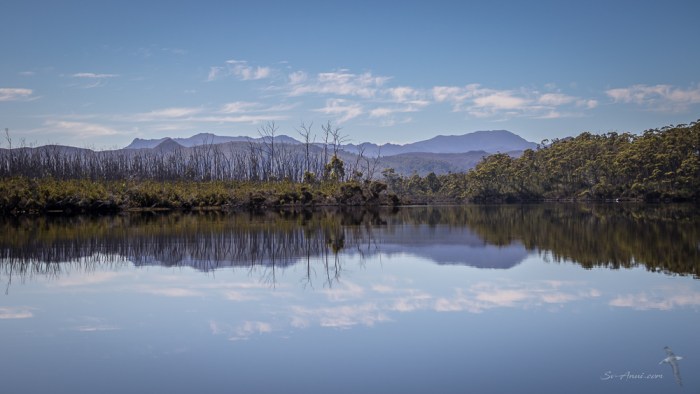
With hardly any wind, we had ideal conditions to dinghy up the Davey River to the gorges.
Surprisingly it is a very wide barred entrance to the river from the Port Davey inlet and the first challenge is to get through the line of breaking waves and very shallow sand banks. But once through, it deepens again. Because it is a long trip upriver, it is best done with a dinghy that planes. So our friends on Discovery II came with us and the four of us piled up into Anui’s dinghy for that excursion! The river is initially wide and meandering, and on a calm day you get magnificent reflections of the mountains and vegetation onto the water.
Eventually the river narrows as you reach a series of three gorges. The first was easy to negotiate, the second a little more challenging with shallow propeller-eating rapids. We got off the dinghy and dragged it along, then jumped back in. The third was just too tricky for us to get through given the low water level. So we turned back.


Coffin Bay and the Sea Caves
Our second anchorage in Port Davey was new to us, at Coffin Bay, opposite Bond Bay.
Can you spot the third boat in there? It is a fishing cruiser. The skipper, Stew, was very friendly and generous, giving us and Discovery two crays each! You can guess what we had for dinner for the next nights, one of them on board Discovery with a lovely Tasmanian bubbly!
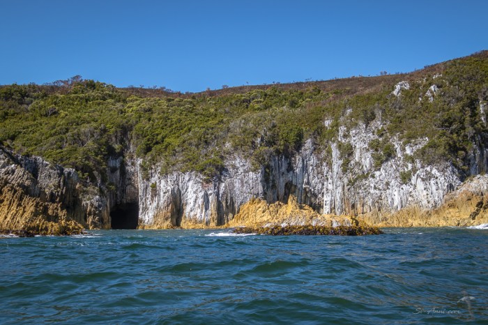
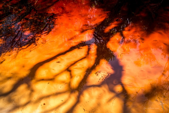
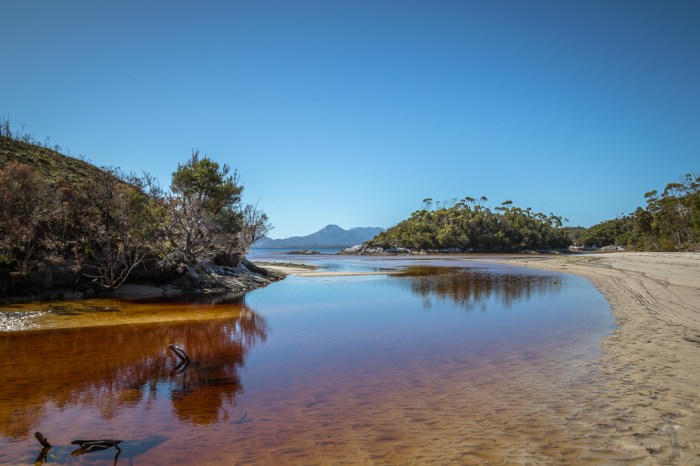
An interesting feature at Coffin Bay and further along to Wallaby Bay is the sea caves in the cliffs that edge the shoreline, best viewed with the afternoon sun shining on them. The swell is forever present even in calm conditions, so we did not venture too close in the dinghy, but it was spectacular. All along the craggy shoreline is bull kelp. We could not help but dunk the underwater camera in the water, leaning over from the dinghy to take some shots of the thick, leathery, strap-like branches. Bull kelp grows quickly, sometimes 25 cm (10 inches) in one day. Also fun was beaching the dinghies and following a little tannin stained creek with amazing reflections, textures and colours.


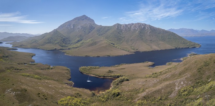
Bramble Cove and the Breaksea Islands
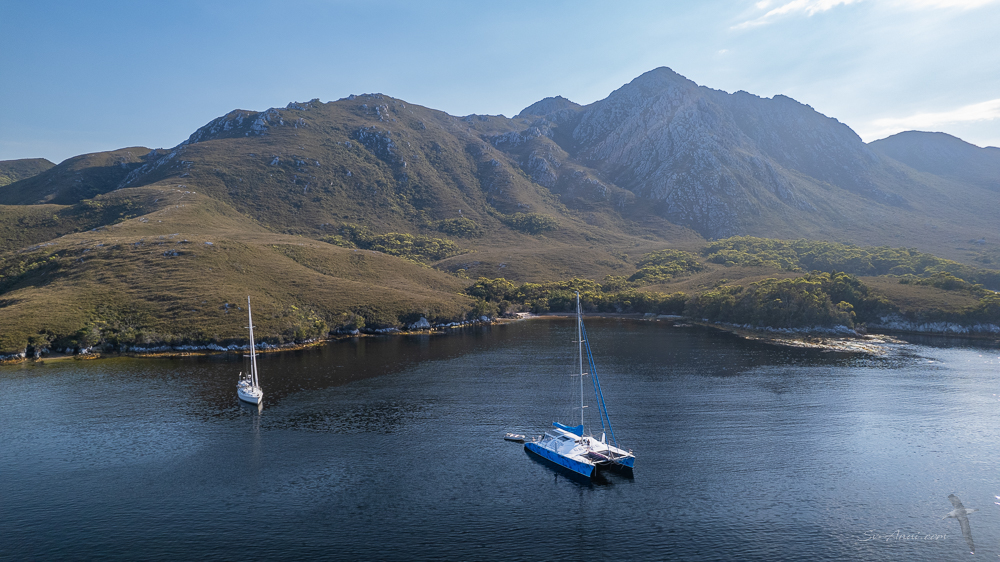
Our last anchorage in Port Davey before heading into the Bathurst Channel was at Bramble Cove. This cove is overlooked by Mount Stokes on the eastern side, 484m high, and the entrance to the cove is protected by Mount Milner (186m) with its steep ridge line climb. We have no photos to show for the effort as Chris wiped them out without realizing! We have a few aerials though!
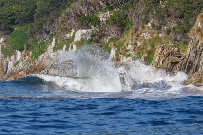
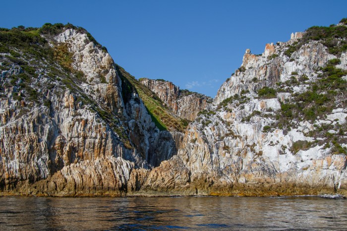
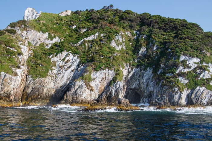
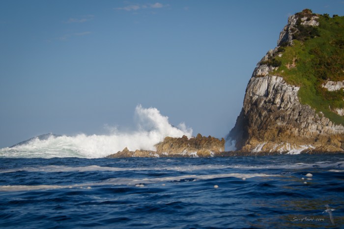
While anchored at Bramble Cove, the Discovery crew joined us again in the speedy dinghy for a wild ride to the Breaksea Islands, a group of six islands so named because they protect the harbour from some of the Southern Ocean swell. We went there to have a look at the sea caves.

It is quite an experience to come close, something you can only do in calm conditions. Wade was in charge of driving and keeping us safe from rogue waves while the rest of us were taking dozens of photos. On the protected side, the morning sun glints off porcelain-white quartzite cliffs. Jagged rocks jut skywards like vertical razor blades, fleshy bull kelp sways with the swell, the surge sends whitewater frothing skyward, waves thrash against rocks and enter caverns, spurting water ten meters up from the blow holes. On the exposed side two-meter swell is still rolling in even in calm weather, crashing onto the cliffs and rebounding, creating very choppy conditions, sea foam and sea mist.


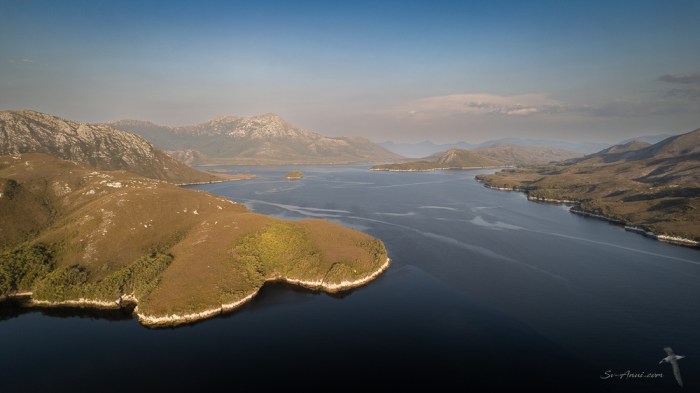
Bathurst Channel
The next part of our explorations took us to the Bathurst Channel, a narrow stretch of water that links Port Davey with Bathurst Harbour. We anchored in several different coves, for views of the magnificent ranges, hikes ashore and glorious photo opportunities.
Schooner Cove
We spent a night at Schooner Cove, not so much to climb surrounding hills as it was just too hot – 30oC – but to capture some spectacular aerials of the Bathurst Channel when we first arrived, then at sunset and sunrise. We were fortunate to get those shots before the wind picked up, the smoke haze invaded the valley and it started to drizzle.

Casilda Cove
Next stop when the weather improved was Casilda Cove, where we climbed Balmoral Hill for the best value for effort views of anywhere along the Bathurst Channel.


Iola Bay and Mount Rugby
We then headed for the little nook of Iola Bay, sublime in dead calm conditions with Mount Rugby towering over us. You would not want to be here in windy weather as it is a tight anchorage with soft mud, but we were blessed with nil wind, mirror reflections, golden light in the evening and a pink glow to die for in the morning.


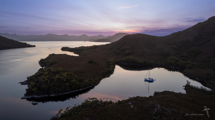
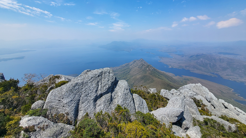
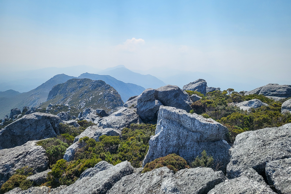
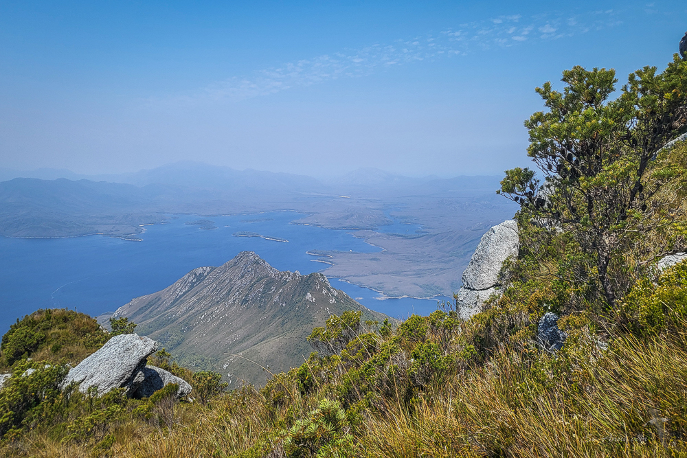
Wade was going to scale Mount Rugby (727m) by himself, however found a couple of buddies to go with. We had hiked up this challenging mountain before, but Chris passed on climbing it again… too arduous given her medical issues.
With the fires raging in the northwest, the ranges get very hazy, which affects the clarity of the panoramic views at the top, but Wadie did take a few nice photos.


Today as we post this, we are moving into Bathurst Harbour proper, for more breathtaking anchorages and shore wanderings. Join us next week to continue exploring this magnificent part of Tasmania.


Amazing coastline … and amazing photos Anui! The climbs are well worth it. A great read & particularly loved the ‘dawn at Iola Bay’ pics.
Hi Amanda, it is a very worthwhile trip and we are enjoying the variety of activities. So many photo opportunities… It is hard to select just a few to give readers a feel for this amazing place. Iola… a favourite in settled conditions, but would not like it in strong wind… it swirls and the bottom is very soft.
what a gorgeous spot
Very rugged and remote!
😊
Thanks for the beaut story. I’ve walked part of the SW, but your access from the sea shows how little I really experienced. It’s such a different place in fine weather. 😊😊
Yes it’s the best, but it feels odd to be here without the roaring winds, believe it or not!
Good job gents on your ascent Mt Rugby. Your expressions suggest it was a hard one. Well done!
It was!
Am absolutely thrilled to have some usage of the Internet back after a week’s ‘painful’ absence . . . (blooming local WiFi!) to see these fabulous photos of the West Tasmanian coast! And it is great to see you have compatible company. The Sea Arch at Wallaby Bay looks unreal – all the scenery actually absolutely magnificent . . . oh, I do hope the weather gods will be kind in the days to come too . . . and, and a soft stroke to Bengie who has not been able to be as much of a photo ‘star’ of late . . .
Hello Eha, aren’t technology hassles a pain!
This part of our voyage has been stunning and having such calm conditions means we see the area in its brilliance: calm anchorages, mirror like reflections, the ability to get close to cliffs, lots of bush walks, the breathtaking drone flights… We have been here several times but this is the best experience. A few more boats about than 7 years ago, however the crowds are in Hobart at the Wooden Boat Festival for a few more days!
Bengie has not been off the boat – National Park – and snuggling under the duvet as it is chilly! I’ll include a few shots of that in the next post!😊 🐈 😘
Stunningly awesome country. Your drone pics really illustrated how majestic this place is! Enjoyed your dingy journey upstream, and the goose wing , sail set…. Don’t remember you doing that in the tropics!?!
How blessed were you with the weather? Millpond conditions in perhaps the wildest, wettest part of Oz. Great pics again Chris 😄
Hi Elgar, we are very lucky indeed, especially since this region can receive 2.5 to 3m of rain a year! Never have we seen it so warm, so sunny, so calm… it does not feel right, but we enjoy it while it lasts and try not to think about climate change and global warming!
Hmm, wordpress not letting me comment any more 😕
Well this has come through!
Had to reset my profile etc
It’s such a unique and majestic part of Tassie. Love the photos. We’ve managed one circumnav of the Breaksea Island in glass out and then three days later sat out 70 knots at Kings!
Looks like you’ve had divine weather for the trip. What a treat ❤️
Divine weather indeed… unheard of! It is brilliant. Today was our first day of 30+. We are at Moulters and it calms down overnight! Trying not to think about how climate change is affecting SW TAS!
❤️❤️🩹
Some very interesting anchorages in that part of the world. Thoroughly enjoying reading your adventures each week.
Glad you are and thanks for the feedback 😊
There are so many fascinating parts about your journey that I can’t decide which one is my favorite: the sea caves, sea foam, albatross sightings, coastlines!
The underwater kelp is cool. We use a lot of kelp for our soup base in Korean cooking.
Safe travels!
Hi Esther, it is a varied trip and we are glad you are enjoying the virtual cruise. We love the kelp too, so sculptural… interesting about your use of it in soup! We have collected sea lettuce, and used dry nori, but no other kelp.
Yes, I’m enjoying it very much! Yes, we just use it as a soup broth base and it’s supposed to give it a natural msg taste. lol
I’ve seen sea lettuce at low tide and the little ruffles and color are amazing!