We made it to Eden then Bittangabee on the south coast of NSW and have been in the region for a week, with persistent contrary winds. The long wait is almost over though!
Here is our track this week: one long 150nm passage then a tiny 12nm hop.
Gerroa Headland to Eden
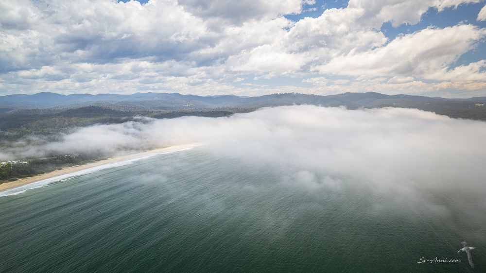
After a windy arrival at Gerroa last week, when we saw 38knots on the instruments, things calmed down overnight. We woke up to heavy fog, not a breath of wind and flat seas. We could not see the shore, the hills, even the bow of the boat was a bit hazy! As for the water it was dark brown from floods at the nearby Shoalhaven River!
With both of us keeping a lookout in the sea fog for anything floating about – vessels, logs, debris – we made our way out of the bay and slowly started our trek to Eden.
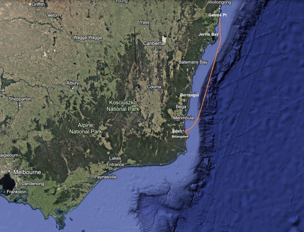
The tall escarpments of Jervis Bay appeared in the mist in the distance. Even in calm conditions, when you pass those 60 to 90m high cliffs, the sea is lumpy!

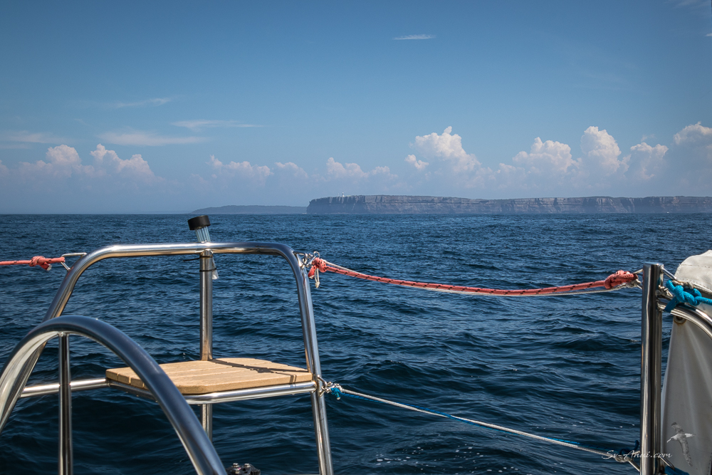
By late morning, the breeze had picked up a little and the visibility was good, so we opened the coffin – the locker under the catwalk between the two hulls which contains all sorts of things, including the spinnaker!
Having not used our spinnaker for a long time, we were very rusty on the set up, but we got there in the end, deployed it and spent the next few hours cruising along without stress.
We are always a bit nervous when launching the big Bluey. It is huge, quite a job to organise, and if things turn sour it is a handful to bring down! Bluey is also what we call our tie dye sail – faded in places, bleached by the sun, a few tiny pin holes, a couple of rust stains… An original sail on Anui, it has seen better days and every time we fly it, we wonder whether it will be its last! But somehow it keeps going and once up in light conditions, a spinnaker run is very cruisy.

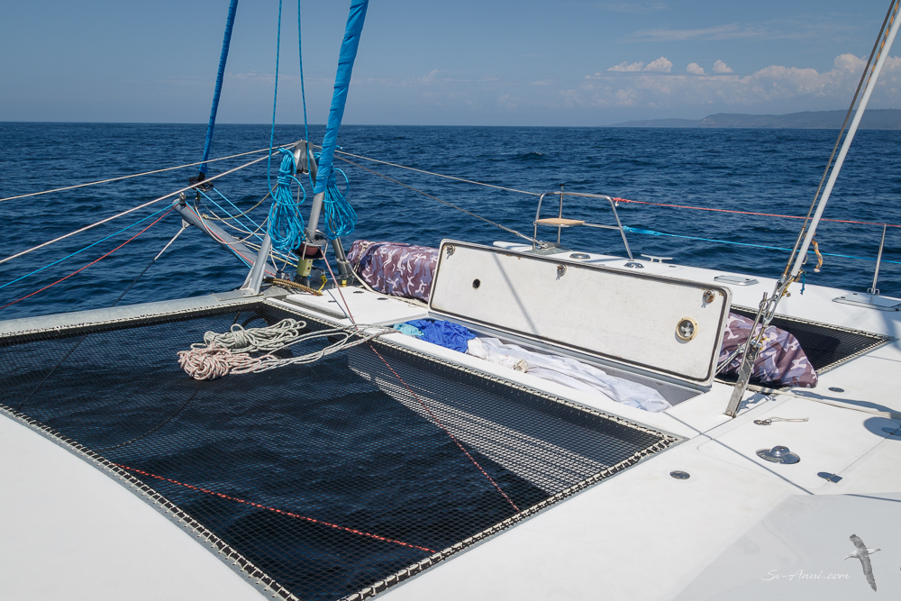
We kept it up for a while, zooming along nicely, but then the Cumulonimbus clouds started developing with anvils forming all along our path and the rumbling thunder started. We had a knot in the stomach!
With more and more mist developing, we could not see what impending doom might get us, so we pulled down the spinnaker and swapped it for the jib, a much easier sail to manage if things become wild. However they did not. It remained grey, with reduced visibility; we stayed just ahead of the thunder clouds, and we kept sailing, although at a more restrained pace. From then on and well into the night it was an endless process of sail changes as the breeze was coming and going, changing direction, and the sea fog returned. By 3.00am we gave up on the sails and just plain motored. It felt like we were going into a wall of fog, so we were doing 360o visual checks every 10 minutes! If anybody was out there, they would have had to be awfully close for us to spot their navigation lights! The only highlight: lots of phosphorescence as dolphins joined us and our wake was glowing in the dark.
We made it into Eden on Saturday, arriving at our anchorage at Boyd Beach, Nullica Bay at 6.00am after a 23-hour passage. It was drizzling, but the sun came out later in the morning, although the sea fog was never far away.

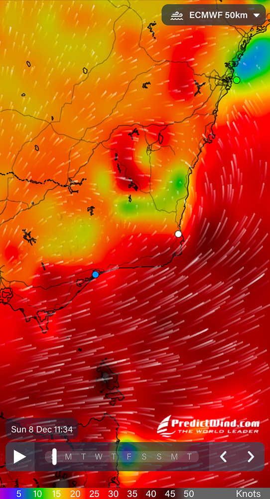
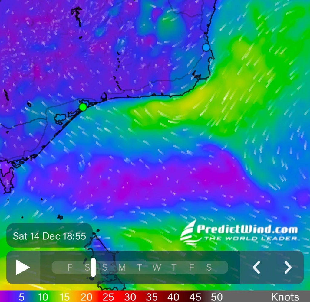
By late afternoon, the Southwest change was upon us, and it remained windy for several days. This is what the Predict Wind weather map looked like:
Killing Time
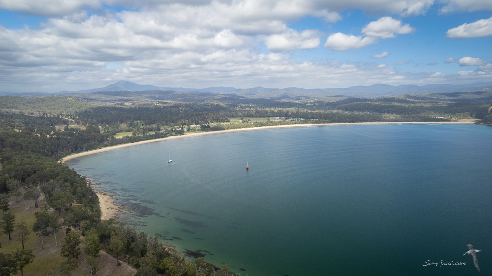
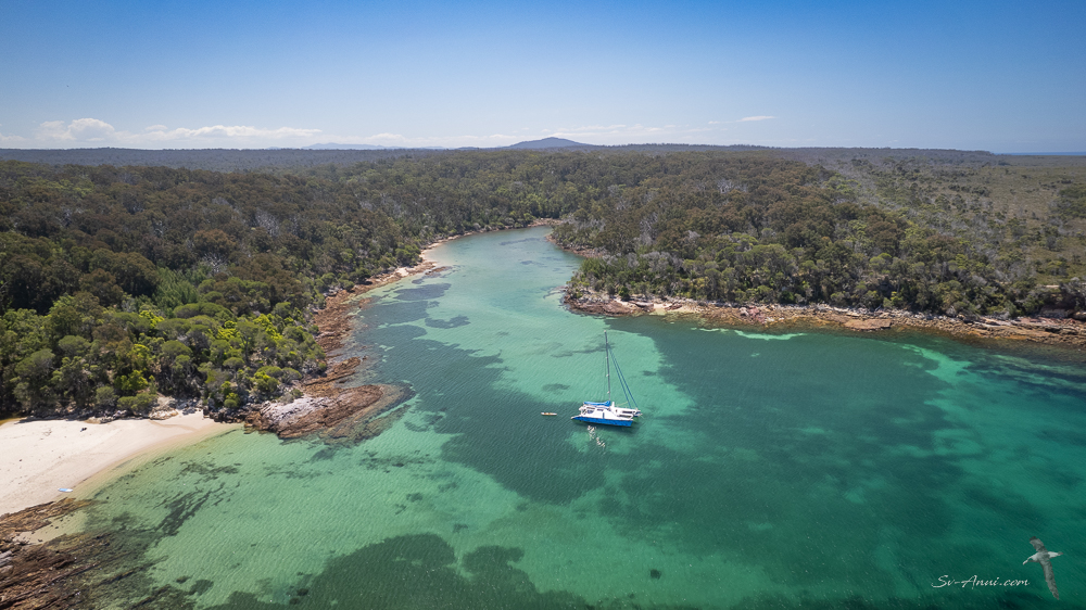
The picturesque town of Eden is set on the deep natural harbour of Twofold Bay and is surrounded by National Parks with beautiful beaches, hidden coves, coastal hiking trails, fascinating history and geology. Twofold Bay is a mecca for fishing, whale watching as they migrate up and down and diving. The bay covers an area of over 30 square kilometres with two distinct bights, Calle Calle Bay and Nullica Bay. We were tucked in at Boyd Beach, Nullica Bay for several days, in the company of Hybrid Ark, a vessel looking a bit like a pirate ship on a solo circumnavigation of Australia.

We have been killing time while waiting for our weather window: beach walks, paddles in the kayak, drone flying when it is not too windy, long dinghy trips to town to buy some supplies. It is not a bad place to be if you are going to be stopped in your tracks for a while, which is why we pushed to get here.
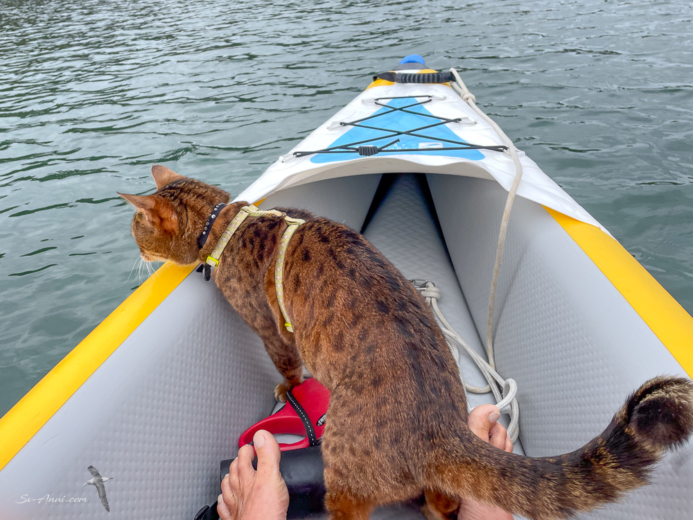
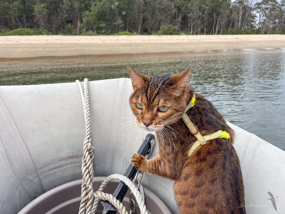
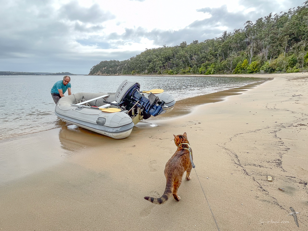
Here are a few images taken while at Boyd Beach.


Even Bengie has been having some fun. Every morning we have been taking her to the beach – in the dinghy at first, then in the kayak. She loves the kayak. She is raring to go for her early morning ritual, standing while we put her harness on and walking down to the sugar-scoops by herself. The happy little meows as she balances precariously at the bow tell us she is quite excited. She trots in the sand, albeit with a bit of a limp, chews on a few grasses, sniffs around and is in no hurry to get back to Anui. She still likes a little adventure. Not bad for an old girl!


Eden to Bittangabee
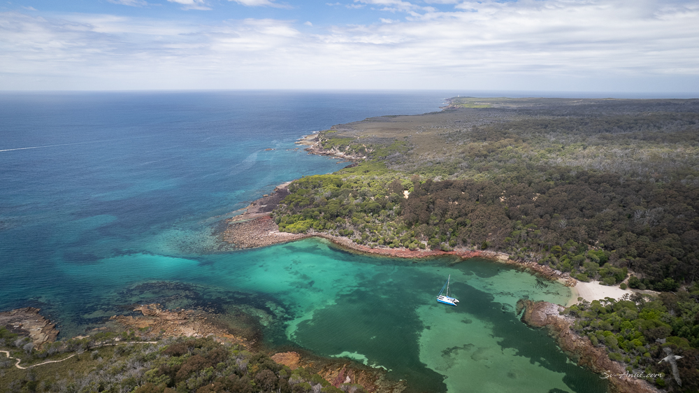
As the wind was easing and we could see a possible window approaching – maybe for the weekend – we could not resist spending a few days at our favourite nook, Bittangabee Bay, just 12nm further along the coast. We made our move on Wednesday and have had three gorgeous days there.
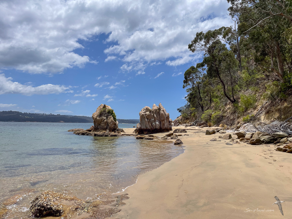
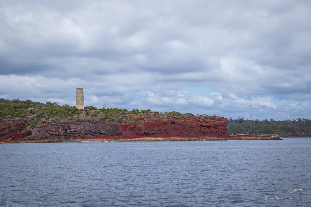
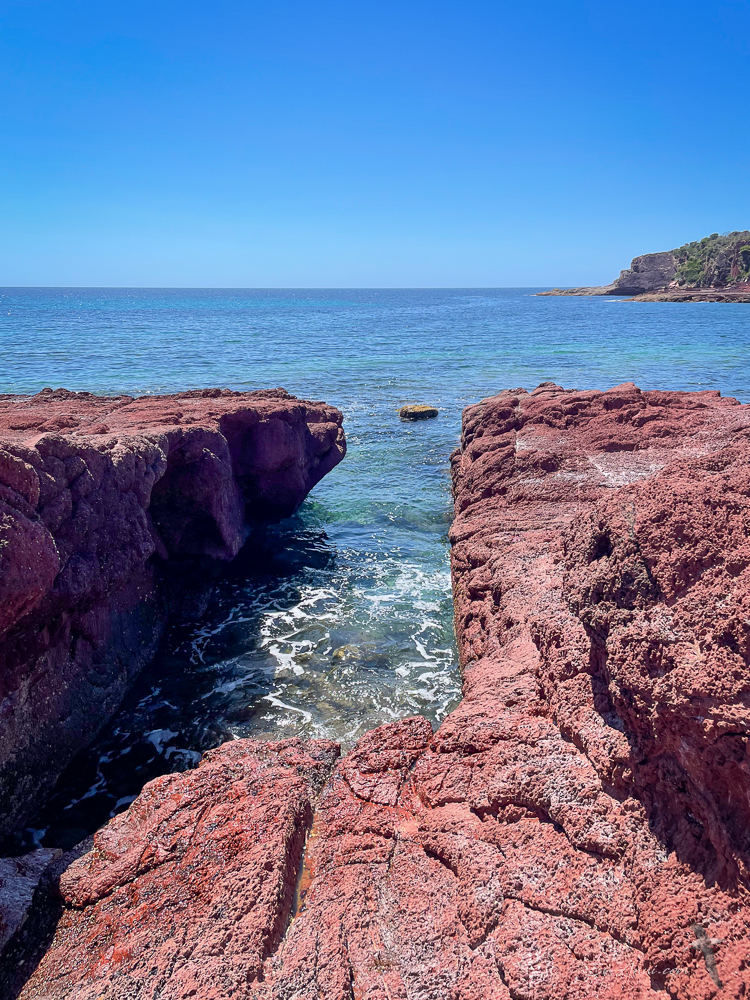
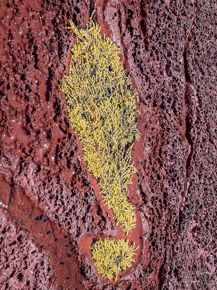
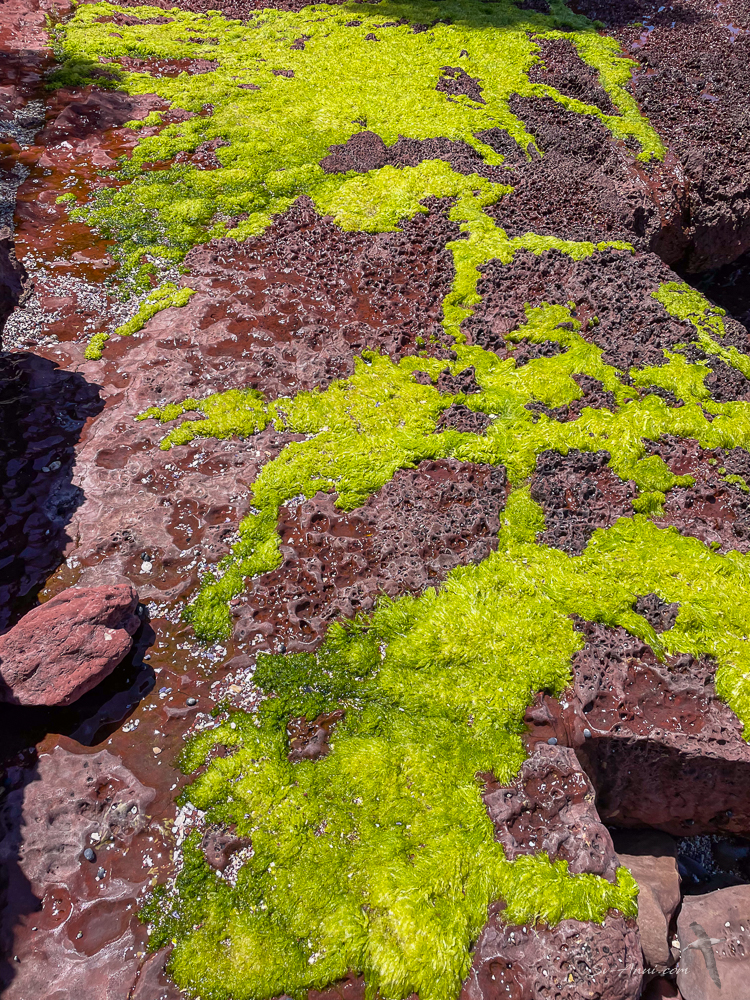
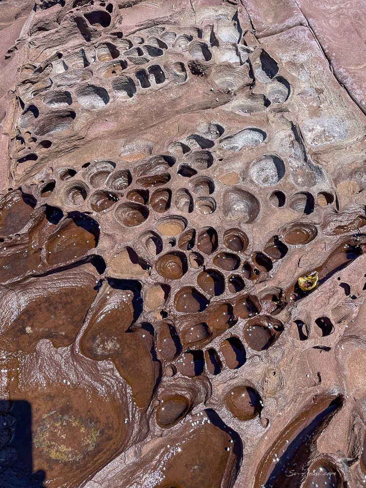
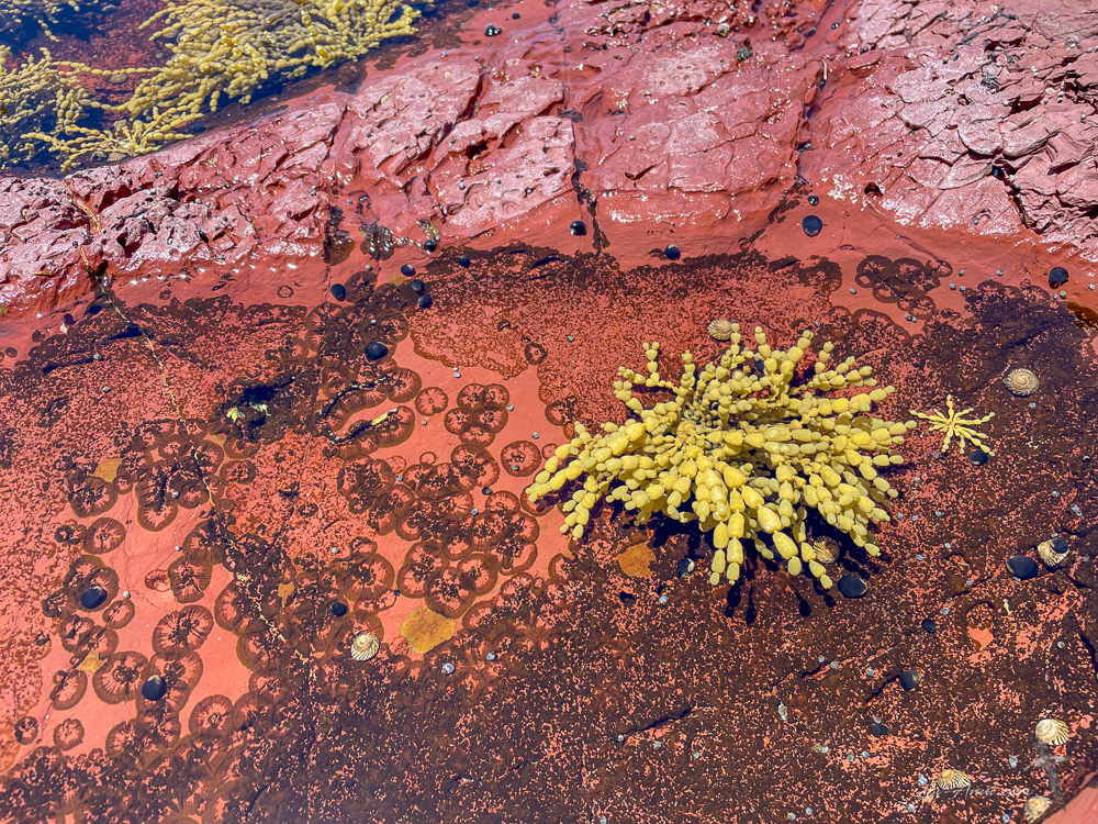
The cliffs and headlands as you move south are a deep red – because of iron oxide, also known as rust, which was produced by weathering over millions of years. The pink sandstone and red mudstone give this part of the coast its distinctive look.

It is very tight to get into Bittangabee Bay as you snake around the shallow reefs; wind and swell don’t always allow you to enter, and if another yacht is in there, it gets a bit too cosy. But in the right conditions it is a lovely spot for a change of scenery, secluded anchorage and great bush walks. We were delighted we were by ourselves, except for the usual campers who access the bay via 4WD tracks.


Our walks were all about the red rocks and textures:


So what’s next and when?
We are tantalizingly close to the Gippsland Lakes, our launching pad for Tasmania, only one overnighter away or two day-sails. We are obsessively checking the forecasts, waiting for the right conditions to bolt around the corner and sail to Lakes Entrance.
As you can see from the satellite chart at the beginning of the post, to get there you must follow the coast south then west into Victoria. The prevailing winds alternate between SW or NE at this time of year and the SW weather systems can blow for a while. Eden is the last protected all weather anchorage on this part of the coast. Once you leave Eden you are committed to either going around the corner into Victoria or head south to the East coast of Tasmania. Yachties have been known to remain stuck in Eden for ages, waiting for the elusive weather window! It looks like we might be able to do the dash this weekend after spending a week at anchor.
This is the forecast on PredictWind. The blue dot shows Eden, the green dot Paynesville in the Gippsland Lakes.
For us going back to the Lakes is like coming home. This is where we moored our previous three boats, so it always feels welcoming and social. Provided the weather cooperates, it might not be a long stop, but it will be a busy one. We intend to briefly catch up with a few local friends we haven’t seen since COVID, pick up our guest Trevor, provision the boat then head south to the Bass Strait Islands and eventually start our lap of Tasmania.
Fingers crossed you will find we have come and gone from the Lakes by the next post!


Almost there! Love the rocks, and delighted there is still adventure in the old girl! x T
Thanks Trish. We are pleased we can take Bengie ashore. She needs the exercise just as much as we do.
Bengie is amazing so like her parents! I have looked after many cats over the years and they are so like there owners as I can see Bengie is. Gerroa is a favorite spot & wish I had a property on that headland. Safe travels & I hope 2025 is healthy for you both.
Gerroa is a beautiful spot on the south coast and there seems to be an active surfing/ paddling community. Our anchored boat has been known to be the turn point!
Funny about cats and their ‘parents’… she keeps going and so do we!
Wow, I love the many beautiful photos, guys! The bay looks too shallow for Anui to get in that far but you did of course. How many feet of water does the boat draft? We don’t use the metric system here. Safe travels to Tasmania!
We are anchored in 2.5m at low tide – about 8ft. The inlet is very shallow and the track to get in snakes around the rocks. Anui draws 1.2m or 4ft.
Wow, 4 feet is a rather deep draft, I can see the inlet snakes from the drone photo, the place is beautiful! You two are blessed to be among such beauty. 😎🇦🇺
It is an absolute favourite. Our previous cat Take It Easy had a shallower draft and we used to get around the corner into a small hole but it dried out around us. We can’t do this on Anui.
I see, I remember your other Cat! The lake I grew up on in Michigan has become shallower than it used to be 40 years ago, nothing stays the same, does it…
hope you’ve got some time to say hello !!
Tom&Lou xx
We are counting on it, guys, lots to catch up on! We should be in the Lakes Sunday night and will make our way to Paynesville on Monday… could stop in Metung first!
A bonus getting in to Bittangabee while ‘waiting’. Great photos Chris as always. Enjoy the Lakes!
Hi Amanda – yes lucky to be able to spend a few days.
Glad you’re finally going to make it!
Hey Ryan, third time lucky!
Well, I know my plans for tomorrow morning – a study session of geography and meteorology of the SE corner of the mainland – don’t think I know as much as I should :)! Love your photos as usual and think Bengie and I actually have a lot in common character-wise 🙂 ! Can’t wait for you to get to Tassie . . . but love and best for now!
Hello Eha, looks like we will make it to the Lakes soon and maybe, just maybe will be celebrating Christmas somewhere in the Bass Strait Islands!
Bengie can’t walk very far these days but likes to give it a go and loves the glide in the kayak! Hugs 🥰 and stay well.
Ha! Told you Bengie and I have ‘stuff’ in common . . . 🙂 !
The Red Rocks are amazing and the textures interesting! Are the dug out holes from clams that used to live there?
You are so adventurous and knowledgeable about the clouds and navigating in the water.
The red rocks are mud stone – a type of sedimentary rock… so there may well have been borrowing organisms in them. The sediment is exposed to rain, wind, and gravity which batters and breaks apart the rock by weathering. The geology of this part of the coast is fascinating.
Clouds and navigation… well we have been sailing for a few decades so it’s all part of what you learn, little by little.
The geology in that area is fascinating, as well as its red rusty color. I wonder what you’d find looking at those fossils and old burrowing spots. Thanks for sharing your explorations with us!
Yes, all those years of experience is priceless.