We spent 10 brilliant days exploring, hiking and relishing the immensity of nature in Macquarie Harbour. We had sailed here before, but managed to find new aspects to spark our interest. There is so much to see in this unique region!
About Macquarie Harbour

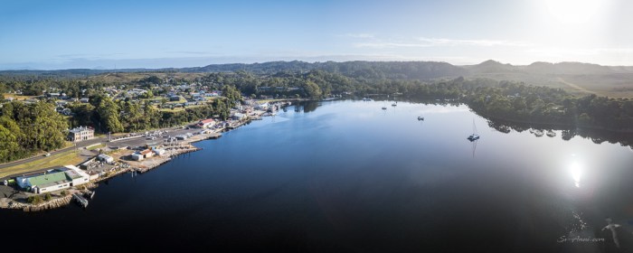
Before taking you on a tour, here is a bit about the Harbour. Macquarie Harbour is a shallow fjord approximately 315 km2. To put this in perspective it is about six times the size of Sydney Harbour. On average the depth is 15 meters, although there are deeper places up to 50 meters, so it is navigable by shallow draft vessels.
As you enter, the water is dark like black tea which is typical of waterways throughout the southwest of Tasmania. It is caused by naturally occurring tannins in the water, leaching from vegetation and being carried through by the rivers feeding into it, the largest being the King and Gordon Rivers.
The first settlement at Macquarie Harbour was on Sarah Island in 1830, Tasmania’s oldest convict settlement and reputedly one of the most severe penal establishments in the history of transportation.
Later the small port of Strahan was developed on the northern shores of Macquarie Harbour to support the nearby mining settlements, mainly Queenstown. Another port was developed on the southeast section of the harbour in Kelly Basin along with the townsite of Pillinger. The settlement and port were short lived as was the North Mount Lyell company that developed the facilities.
A more recent feature of Macquarie Harbour has been the establishment of salmon farms in the 1980s. They are spread across the length of the harbour and production increased significantly in the 21st Century.
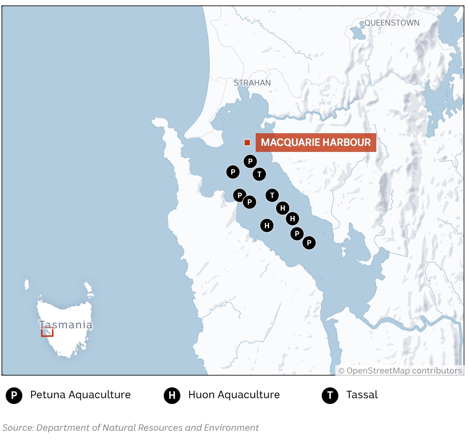

A range of environmental issues have followed the harbour’s industrialization. Problems include the creation of de-oxygenated “dead zones” under the fish pens and massive stock mortality which occurred as stocking and pollution loads increased. The fate of the endangered Maugean skate has also been a subject of concern. It is that same old problem of greed, excessive growth and terrible impact on the environment. Whether the salmon farming licenses will be reviewed remains unclear. Is there a way to have sustainable salmon farming and the environment? We are not so sure!
The Tour Begins!
The harbour map above shows a few of the anchorages we went to within Macquarie Harbour. We dropped the pick in some new to us spots and did a few hikes we had not attempted before. Today we are taking you to just a few of the places that stood out for us. For the full tour, you will have to wait until we publish our visual diary of our Tasmanian voyage!
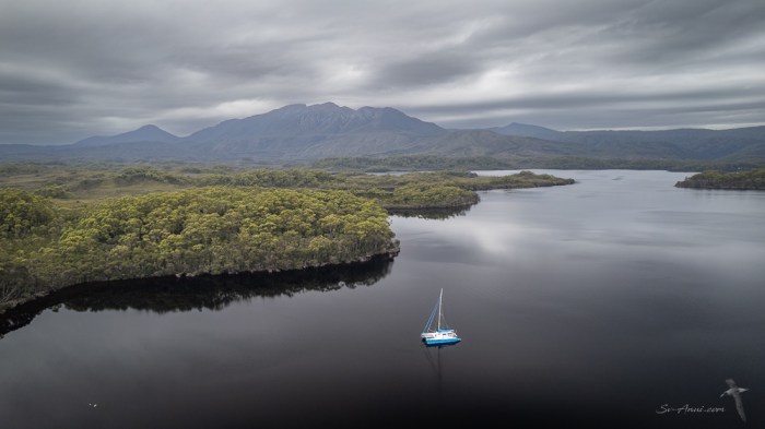
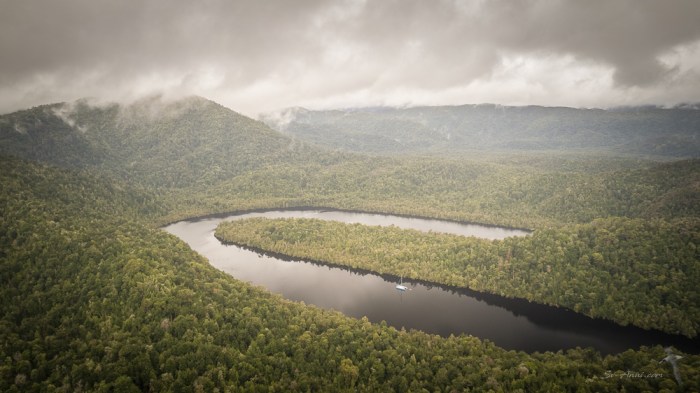
Farm Cove
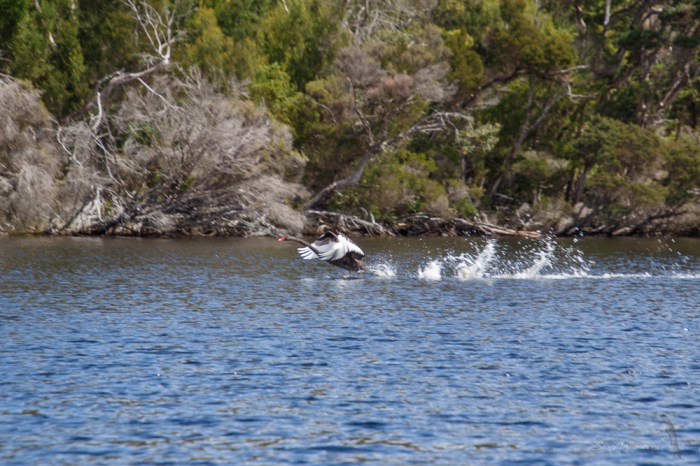
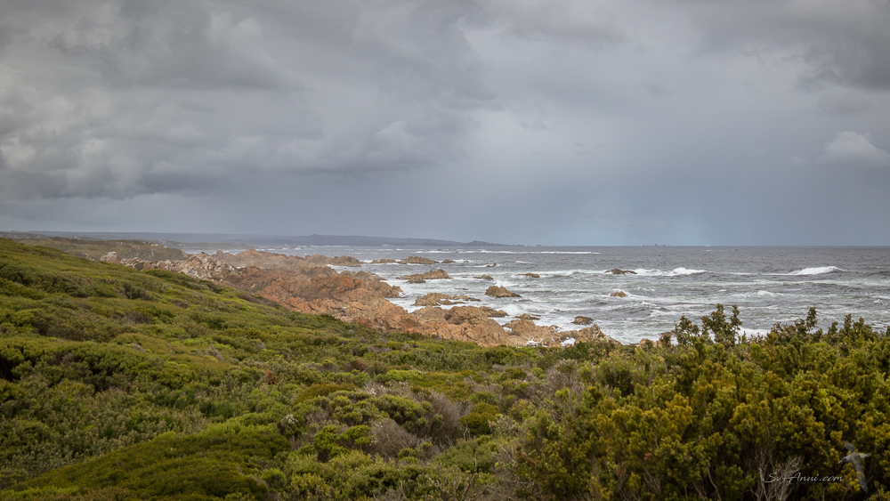
In Farm Cove where Sarah Island convicts had grown pumpkins and onions more than a century ago, we felt miles away from civilization. We are showing you Farm Cove because it is an unspoilt anchorage and Mount Sorell dominating the bay. For once the peaks are clear of clouds despite the overcast sky. This stands out as a great example of what you see in Macquarie Harbour: rugged mountains, unspoilt wilderness, beautiful waterways.
The best part was arriving there in totally calm conditions, not a breath of wind, not a ripple on the water. It was divine with clear reflections into the water of the hills, the clouds, Anui… it was mesmerising. We went for a walk ashore, were visited by swans and dolphins and spent two nights there, totally protected. The next day was cold, 12oC in summer, and we got our diesel heater started. It got a lot of use during the rest of the trip, keeping us toasty warm in the early mornings and evenings.


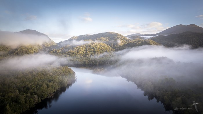
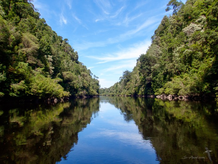
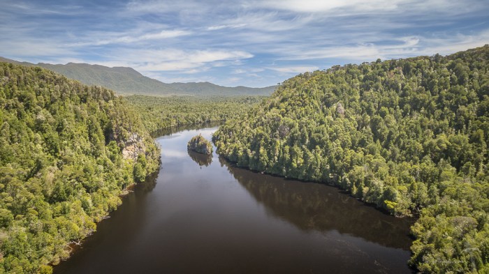
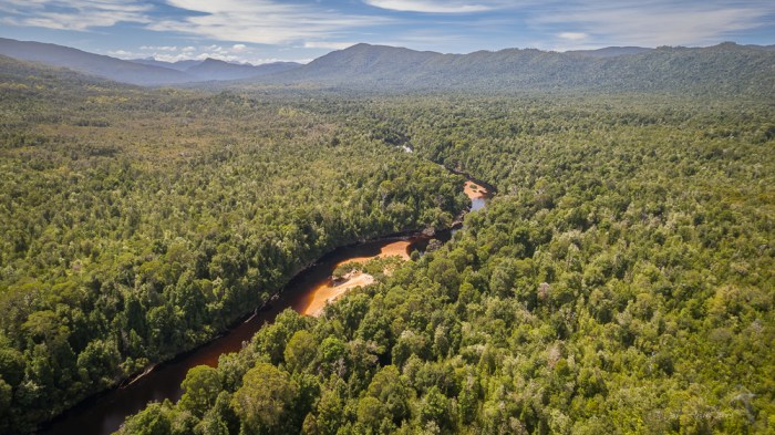
Gordon River
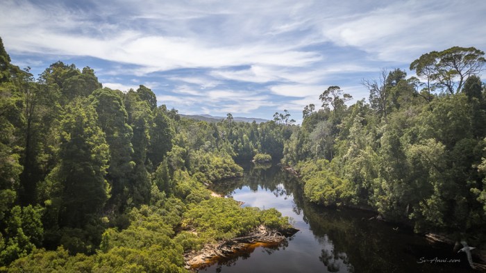
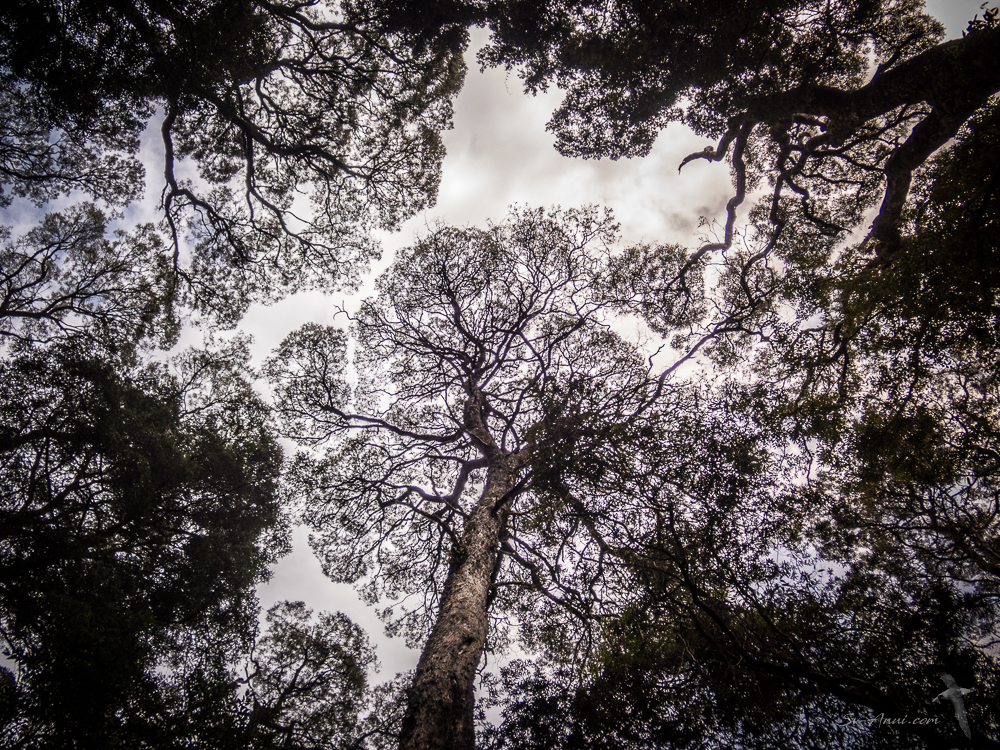
One thing you must do when coming to Macquarie Harbour is go up the iconic Gordon River. It is a natural treasure, navigable for up to 40km upstream of its mouth, then further by dinghy and outboard above Sir John’s Falls. From source to mouth the river is joined by 25 tributaries. It descends 570m over its 172km course, much of it located in an uninhabited wilderness area. The lower reaches of the Gordon is part of the Tasmanian Wilderness World Heritage Area, with a cold climate rainforest and rare trees. Much of the landscape was shaped by glaciers and has a long natural history, with ancient Huon Pines that grow to an age of over 3000 years.
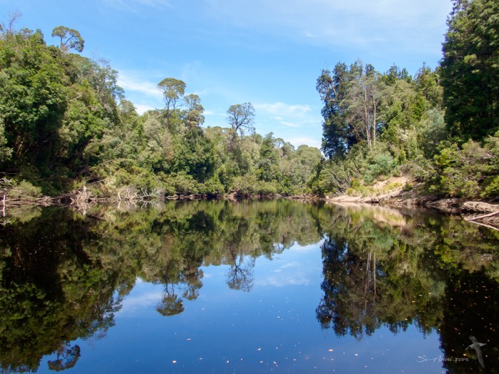
When going upstream what is most striking are the reflections on the mirror-like water on a calm day, which can make it hard to distinguish what is actual vegetation from the reflected image. Another stunning aspect is the early morning low-hanging fog over the river in cool conditions, creating a mysterious and dreamy atmosphere. At every bend of the river, you discover new views, and on overcast days the mist shrouds the sides of the hills, making the scene look like a Chinese water colour.
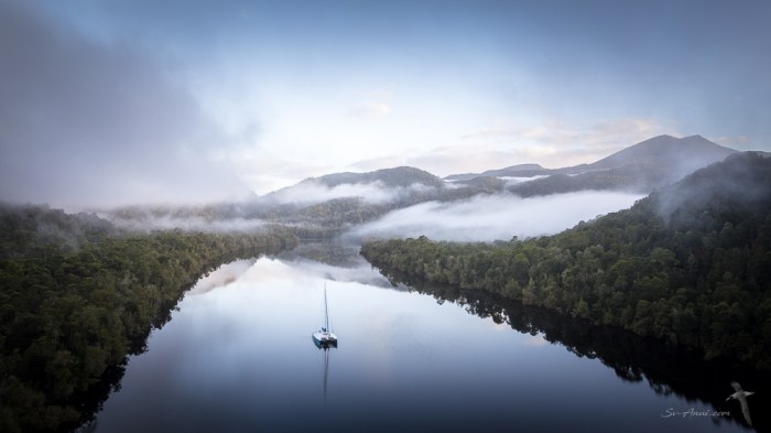

We cruised a long way up the Gordon River, taking Anui to just below St John’s Falls, a beautiful anchorage in a bend of the river, just about as far as you can safely go in a large vessel, then continuing further by dinghy. We stayed for three nights, enjoying exploring and hiking.

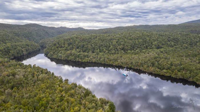
The novelty for us this time was to dinghy upstream past Big Eddy (true to its name) to the Gordon-Franklin Junction and going a few kilometres beyond the confluence of both rivers. The further upstream we went, the more precarious it became, with rocks hidden in the dark tannin-stained water, particularly in the narrower and shallower Franklin. The Gordon continues for a long way, and we followed it for a while too, but turned back as increasingly the combination of sections of fast current, lurking rocks and sunken tree trunks were making us nervous! The reaches further upstream are reserved for kayakers!


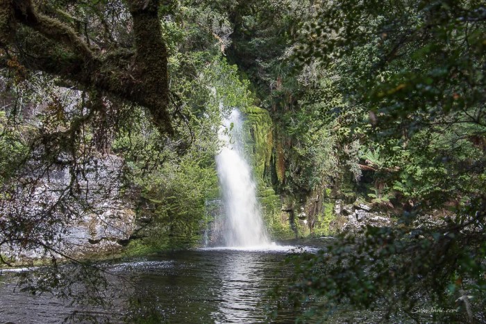
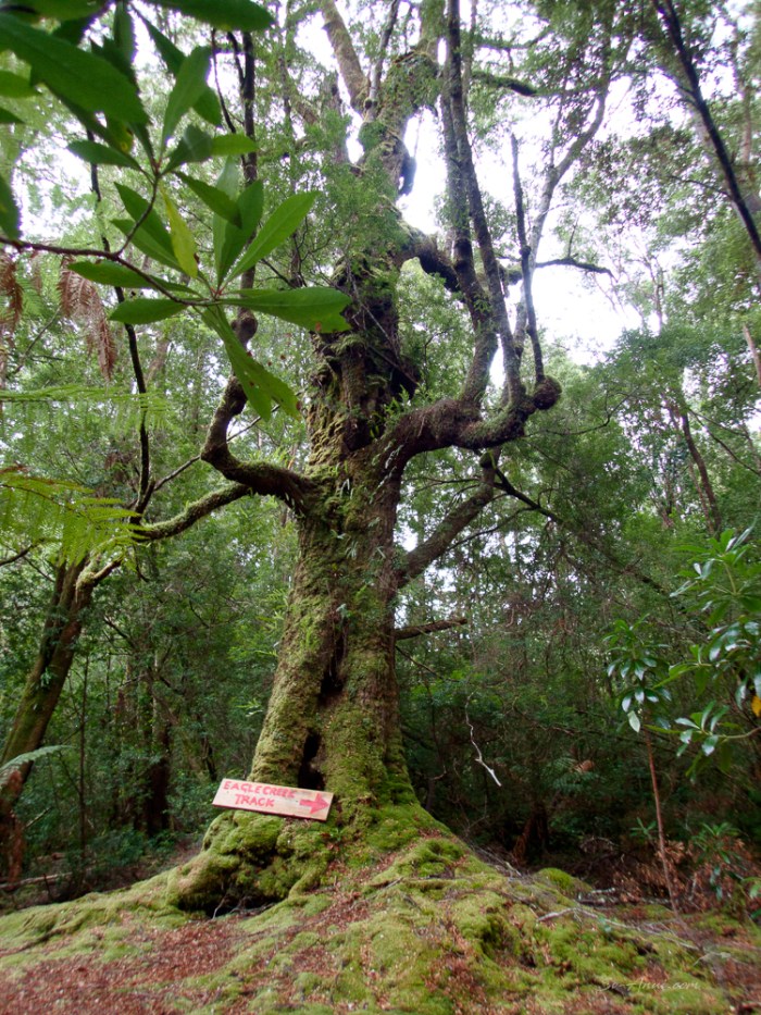
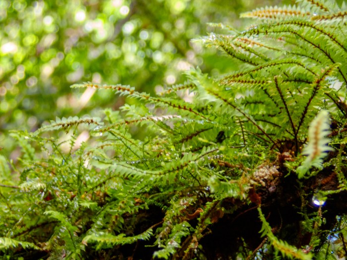
The Eagle Creek Track
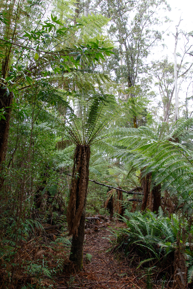
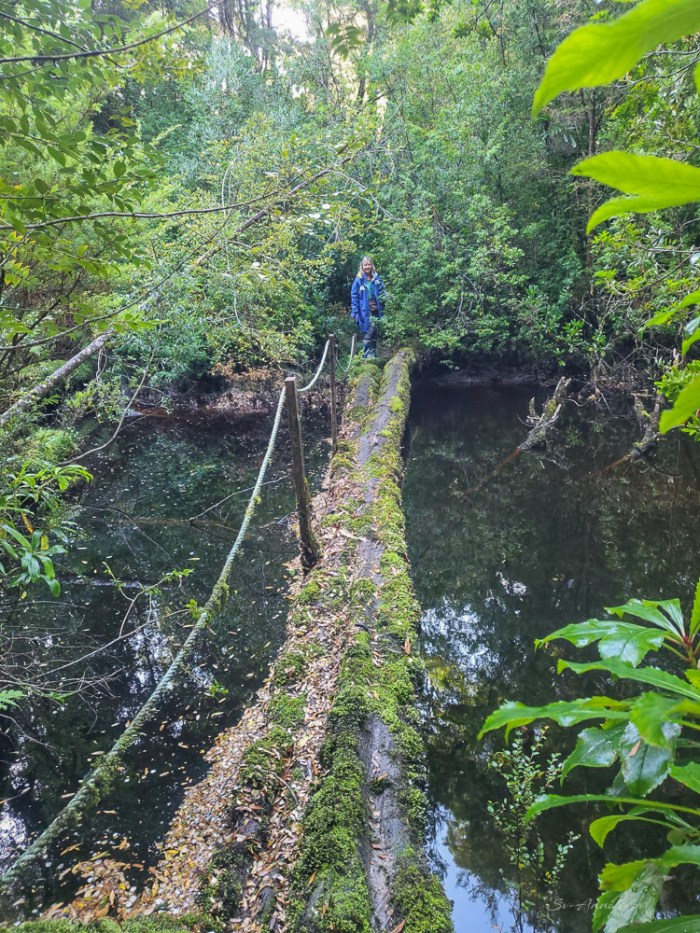
We did a lot of hiking throughout our stay, some of it more akin to bush bashing than bush walking. Most of the trails are overgrown, steep and can be difficult to follow with the surrounding terrain impenetrable. Of all the walks we did along the Gordon River, at Heritage Landing, Sir John’s Falls, the Gould Track, the very best was the Eagle Creek Track, a tiny tributary of the Gordon, 20kms up river.
The trail leads inland towards the Elliot Range and eventually connects to the lower Franklin River. Magical is how we both would describe this enchanting walk among rainforest: a mossy, ferny, green, meandering path following the stream, with a few creek crossings and some challenging sections where large trees had fallen. We saw all sorts of mosses and ferns, lichen-draped branches on large rainforest trees, some we knew like the Myrtle Beech, Sassafras, Huon Pine, Leatherwood, Celery-Top Pine, Blackwood and many more we just did not recognise. The Leatherwood trees were in flower, creating a carpet of white petals on the mossy ground and falling around us like confetti.


Back to civilisation – Strahan
With a possible weather window approaching to head to Port Davey/Bathurst Harbour, it was time to leave the Gordon River and sail to Strahan for reprovisioning, laundry and a few more wanders, notably to Hogarth Falls. That was an invigorating sail the length of Macquarie Harbour in 25 knot westerlies! Strahan is a small town of a few hundred people and a jumping point for tourists exploring the west of Tasmania.


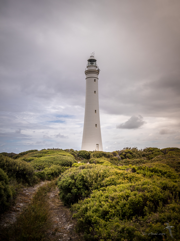
Pilot Cove

With our food stores replenished, our fuel topped up, we headed out to Pilot Cove, our final stop, just outside the entrance to Macquarie Harbour. From there we walked to the Cape Sorell Lighthouse. It was a perfect way to end our sojourn before heading further south down the west coast.
Onto the next wilderness area
We are delighted with our stay at Macquarie Harbour. We did a lot and had different experiences compared to our last visit. We enjoyed breathtaking sights, and we stayed physically active. Sometimes you can feel stuck waiting for the weather, but not this time. While the conditions would not allow us to go south, we explored, learnt and enjoyed this rugged corner of the world without rushing. When we were ready to leave, the weather cooperated!
We have now left Macquarie Harbour and are sailing southward along the wild side of Tasmania. See you next Friday somewhere in the Port Davey/Bathurst Harbour wilderness!


‘Jealous. We didn’t get to anchor in Farm Cove when we were there but it looks beautiful and is on the list. The Eagle Creek Track is also on my list if we get there. Sail safe. Trish
Hi Trish, Both gorgeous, so is Kelly Basin!
Dear Chris – I remember you saying how fond you two were of sailing in Tasmanian waters . . . I thought of the unreal colours in the tropical north, the fish and birds and coral and kind’of said ‘oh yeah’? Well you surely have taught me to think twice! Thank you for this extensive survey of an area in ‘my own land’ I never knew existed. Wonderful scenery 99% of us do not know is there. Shall spend some time on this Friday offering . . oh, do keep on having a fabulous time and hope Bengie in her ‘older years’ does not find matters uncomfortable 🙂
Hi Eha, this part of Tasmania is wild and so remote. Enjoy this very long post… I thought it might have been too long with too many photos, but as Wade said, if people don’t want to read, they can at least enjoy the amazing scenery. Bengie has not been able to have walks and is feeling the cold… like us, but enjoying the duvet blankets and heater!
Wow guys! Tasmania is sooo beautiful!! Thanks fr sharing, I hope you get the next window to the next harbours! Be well. 😎🇦🇺
We have John! Just about to anchor in Port Davey, another wilderness!
Nice reminder for me as to how beautiful Tassie is. Enjoyed the bit of irony, after all your warm tropical sailing, you had to fire up the heating 😉
Roaring 40s soon? Hope the winds are kind.
Hi Elgar, yes we are well and truly in the Roaring Forties but hiding when the wind blows! Lucky to have had good passages down the west coast and calm days.
The post was not too long. I kept wanting more! And of course to to experience the magical remoteness. Have done a Gordon River trip on a commercial boat, but nothing like experiencing it on your own vessel
Thanks for the feedback, Graham… needed to hear that! Yes the Gordon is magical and on your own boat you get to go much further up. The commercial boats go up to Heritage Landing, 10 kms up, we went 20 kms on Anui then further by dinghy.
We enjoy reading your adventures. Absolutely stunning images especially the aerial shots.
Cheers
Mick & Lyn
Hi Mick & Lyn, it has been really amazing to be back in Tassie waters and the West coast in particular is special.